I have teased you like a movie trailer a couple of times now: Akseløya, the tilted hard limestone island. The Festningen profile, where the rocks are tilted into a vertical position, for gentlemen geologists to enjoy during an afternoon stroll. Both owe their existence to a rendezvous between Svalbard and Greenland during the early Paleogene, from roughly 65 to 40 million years ago, a hefty romance that came in places by mighty powers, and which they could not control themselves.
It started much earlier, during the Triassic: The supercontinent Pangaea, a big family of small and large continents stuffed together as one, had finally started to break up. North America started to break up from its triangle relationship with Europe and Africa. A rift between them started to form, from South to North. During the Jurassic, the separation was nailed by the first sea floor spreading between the US East coast and Morocco. Through the Cretaceous, the ocean grew wider, splitting Europe from North America. Greenland, their daughter, had stayed with America for a while, but during the Cretaceous, she tried to escape from America to stay with Europe, by directing the sea floor spreading centre between herself and Nova Scotia. But, the big parents soon decided Greenland would stay with her father America, not mother Europe. The crust stretching moved to the current Atlantic Ocean.
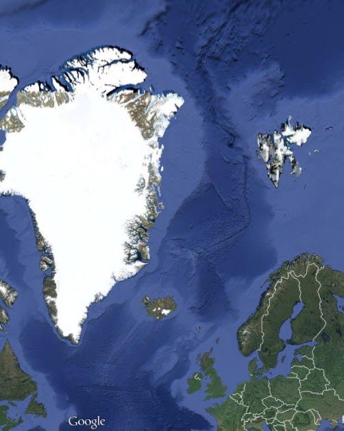
Google maps image (of course) of the North Atlantic. The mid-ocean spreading ridge is the dark zig-zag band in the middle of the ocean, which can be followed southwards as a fish-bone pattern. Note how Iceland resides on top of the ridge because a hotspot happens tp lie beneath the spreading ridge.
To the top, the spreading zone past Svalbard and Greenland has large sideways parts. Svalbard’s original position can be found by (imaginarily) removing the dark blue ocean crust, which would slide Svalbard back, Close to the NW corner of Greenland.
Then, Europe and North America discovered that they had trouble getting rid of each other. The Earth’s shape – a sphere – created obstacles. A look at the Atlantic from above shows that it is widest in the South and then narrows, like a scissor towards the North. Towards the current Artic, the Atlantic ocean had to narrow to a hinge point, like a scissor – and behind, north, of that hinge, the plates would converge, move towards each other. Which is a bummer if the space is already filled and they do not stand each other.
But where there are smart divorce-tectonics lawyers, there is a way. Rather than just a hinge, a curved sideways fault zone opened from the Atlantic towards the Arctic. Europe rotated along it, counterclockwise, and distributed the space problem into the Polar ocean. And Greenland could see a handsome, young land, Svalbard, coming drifting towards her.
Their relationship became short – only around 25 million years – but tight, intense and left them marked forever. As Svalbard drifted towards Greenland’s NE corner, the place wasn’t big enough for the both of them, and the “space problem”, in geo-speak, was solved by folding, thrusting and stacking the rocks, into a small mountain chain. Just like how Himalaya is due to the clash of India into Asia, and the Alps due to the clash of Africa into Europe, only on a much smaller, cosier scale.
Teconics showed itself as an unreliable matchmaker, and the romance could not last. As the European plate continued to rotate, it took Svalbard with itself, and the hefty relationship was forced to come to an end. Today, Greenland and Svalbard can only send longing looks at each other across the North Atlantic ocean, separated by a mid ocean ridge fence. But, may be, one day the next Wilson cycle brings them together again?
Until then, we can spend the next hundreds of millions of years to enjoy the spectactular structural geology along the Western coast of Svalbards largest island, Spitsbergen. Join in for Fold’n’Thrust Belt GaloreTM!
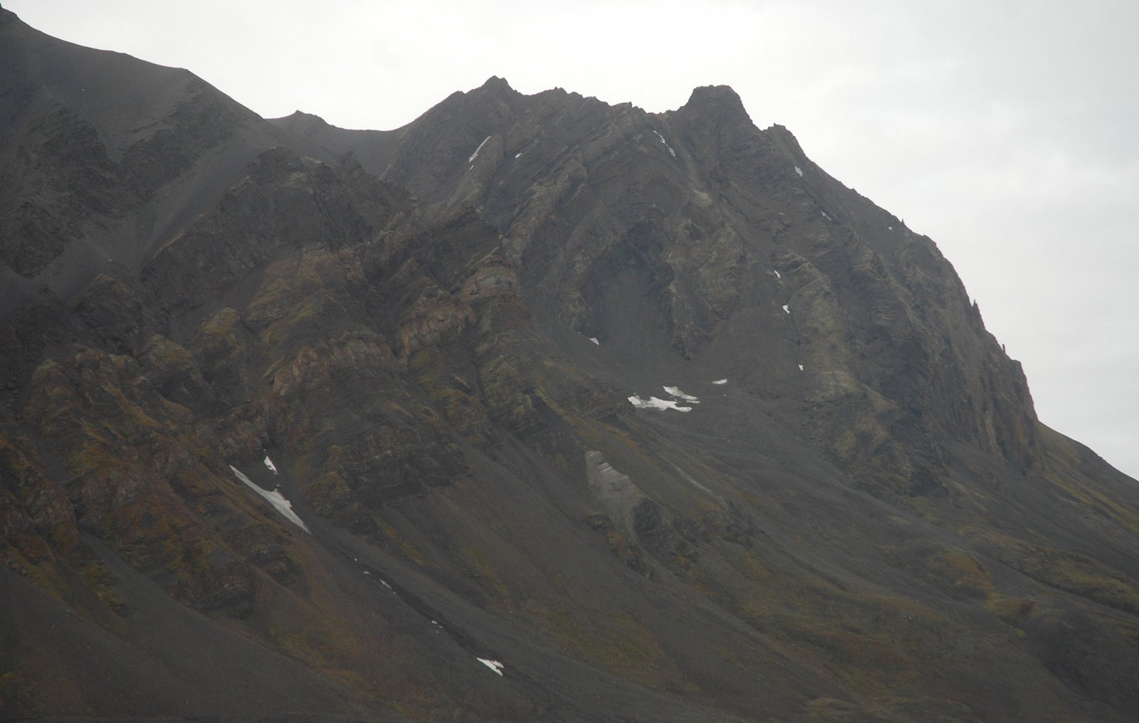
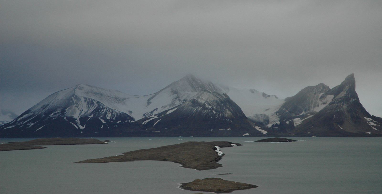
Mediumfjellet, just a short boat trip across Isfjorden from Longyearbyen, is a spectacular overturned duplex; a stack where sheets of rocks are piled upon each other, so that the same layer is repeated several times. At Mediumfjellet, the main rock is our old friend from Akseløya, the hard Upper Permian limestone, with much softer, Lower Triassic shale upon, and soft white salts, mainly anhydrite, below.

Mediumfjellet, seen from the sea on a grey Svalbard autumn day. This image shows the two “horses”, the slices of hard Permian rocks shuffled upon each other, greased by anhydrite and soft Triassic shale. The more irregular piece of rock in the center of the image is a Cretaceous intrusion, which joined just in time to get on the ride.

Eager geologists approaching Mediumfjellet in a too small boat. the rocks in the background are dark limestones of the lower duplex slab.
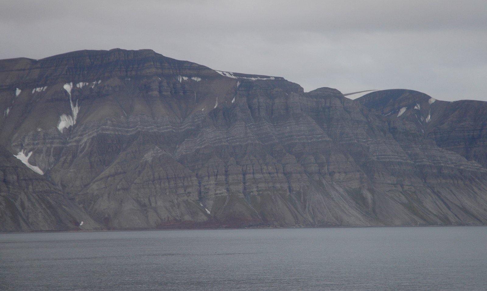
From some distance, in Isfjorden, the overall structure of Mediumfjellet is that it has two floor levels of thrusted rocks: One slab of the limestone has been thrusted upon the base layer of the same, with the soft anhydrite as a detachment, a sliding zone, in between. Then, another slab has been put on top of that again, actually plunging down again past the crest.
A closer look at the inner, Easternmost part of the Mediumfjellet duplex, where the rocks have been pushed so far as to be overnturned.
Just to complicate the picture, an igneous dike also is part of the Mediumfjellet stack. During the Cretaceous, volcanism took place on and around Svalbard, and the dike intruded at steep angle into the older sediments just in time to follow on the ride up the duplex.

Scrambling Mediumfjellet on hard, dark limestone. The big stack itself in the background, making big geologists feel very small.
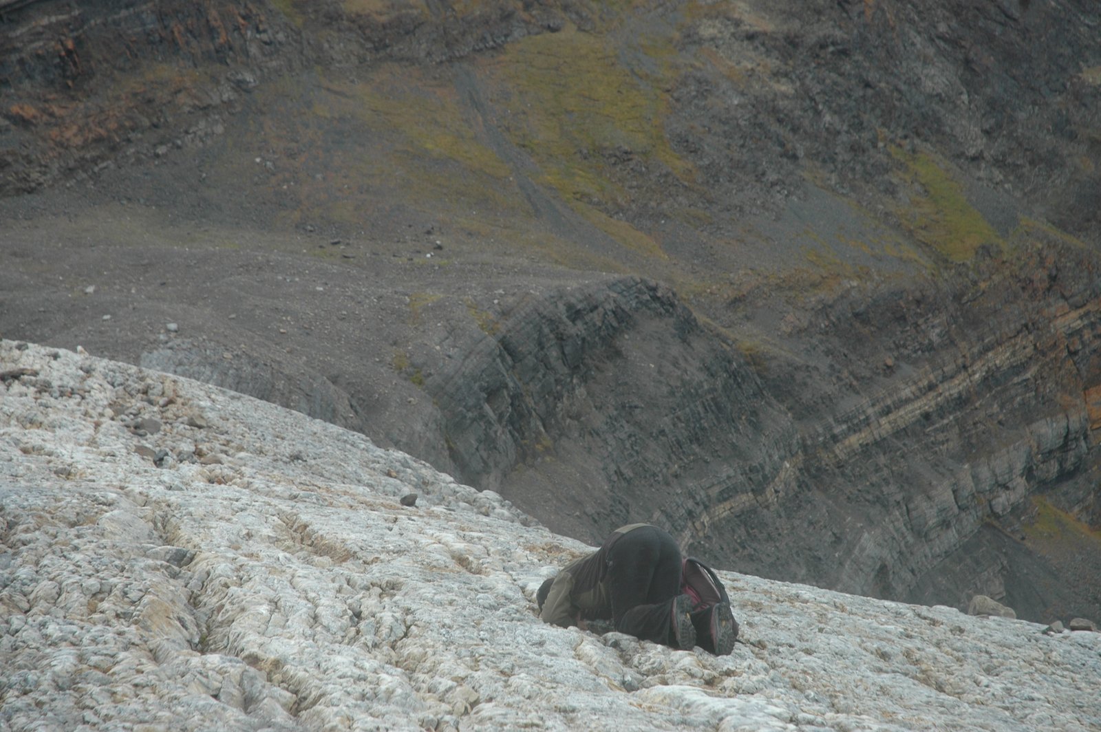
One of the sedimentologists wanted a closer look at the limestone…
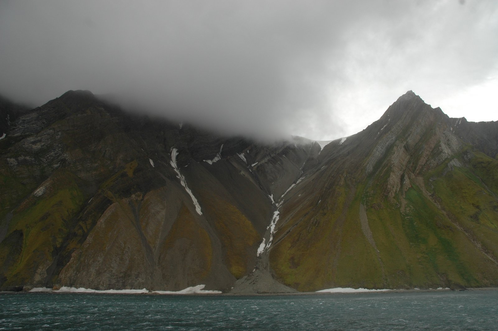
The next images are from the mouth of Hornsund, a fjord on SW Spitsbergen. Hornsund lies within and in the foreland of the thrust belt, and is a paradise for structural geologists working with compressive structures. (It is therefore also a complete nightmare for stratigraphers, “age-of-rock-finders”, to correlate the various units). These images are shot from the sea, so all I can say about their age is “somewhere in the Paleozoic” – likely somewhere between Devonian and Permian. Besserwissers, please join in!

A completely overturned, tight fold at the mouth og Hornsund, with a band of the same brown rock stacked in a series of duplexes below. Complex enough fer yah?
Mother nature’s pallette of light and dark rocks, and all fifty shades of green.
If JRR Tolkien knew Hornsund, he would probably call these the Messy Misty Mountains. I would concur.
And, for dessert, you may enjoy a schoolbook example of a thrust in Billefjorden, just east of the main thrust belt zone.
Quite a sexy little thrust in Billefjorden, accentuated by the banded white anhydrite and limestone and shale of various colours.
Pingback: Karsten Eig·
Wow – love it! Thanks for lighting up my day with that story