Study geology, they said. Join the oil industry, they said.
Travel to exotic and spectacular places, see open landscapes, they said.
See the office landscape and spend most of your time in front of a computer, they said…not!
Yeah, I know. #firstworldproblems.
But, the truth is, many of us studied geology partly because we love the great outdoors.
Being a geologist is an identity for many of us. The rocks are not just something that may or may not contain oil. Rocks are storytellers. They tell the story of the Earth, life, the universe and everything. We need to look at them to read those stories.
We oil people also have good business reasons to go out in the wild. Seeing rocks is important. “The best geologist is the one that has seen most rocks” is a well-rehearsed slogan. Because it is true.
We eagerly grasp every opportunity we can to get out there, to see analogues, geology similar to what we drill into to find oil. Subject to approval from bosses, spouses and minis in kindergarten age.
Finally, in May 2022, with the pandemic behind us, I got out to see real geology again, in Corinth in Greece.
Corinth is a great place to study how the crust is stretched. The Gulf of Corinth separates the peninsula from the mainland, and this gulf is a rift basin. Rift in geologese is a place where the crust is stretched, developing faults to accommodate the stretching, while basin means a place where the crust opens or sinks in, and is filled with sediments – for example a rift basin, where the rift is filled with sediments.
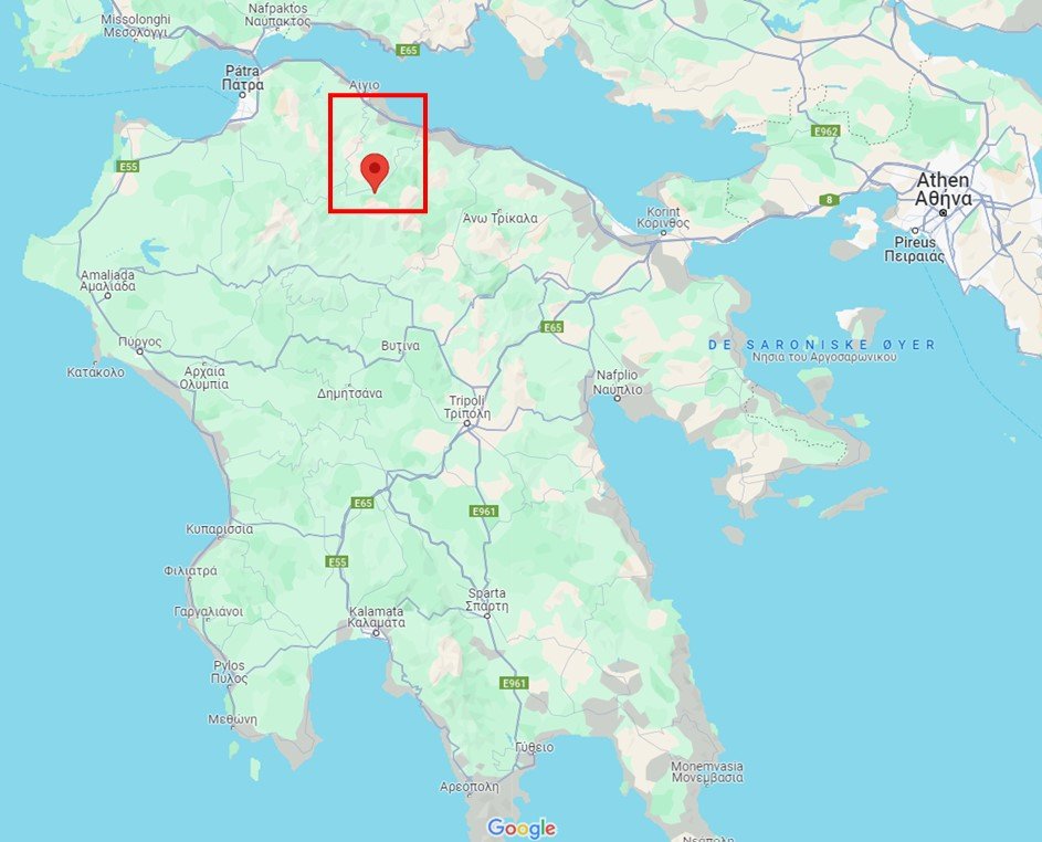
We stayed in Kalavryta, a town up in the mountains on the northern Peloponnese peninsula, and used it as a hub to travel to the localities. The Google maps snip below shows the location of Kalavryta, and the red rectangle outlines the study area.
The trip was led by Einar Sverdrup of the oil company AkerBP. Einar Sverdrup has studied and led field trips to this area for over two decades. The map of the localities is courtesy and modified from his excellent excursion guide to Corinth.
Why do oil people go to Corinth? There is no oil there. But the shape and development story of the rift is a small, young version of the rift that made the North Sea.
One especially important reason for going out in the field is to see the geology at all scales, from kilometers to centimeters. In seismic we only see the reflections set up by sound waves, and while they show the overall geometry, they cannot tell us which rocks are where, or show that sediments are coarsest up towards the faults, and finer away. Neither can seismic data reveal all the small-scale faults that may chop up the big fault blocks into compartments.
The Corinth basin is also great because it is small. It displays all these features across a distance of only around 20 km in its south part, including vistas with overview of large parts of the basin.
Rifting in Corinth is young. It commenced only in the late Miocene, around 10 million years ago. Still, we can appreciate how long that time is:
Compare the tiny stream of sediments slowly filling into the Corinth Gulf, with all the sediments in the basin – three kilometres of sediments above the basement – and we recognize it must have taken a long time to fill in the Corinth Basin. And yet, the formation of this basin is only a blip in the long void of time.
Beneath the water in the Gulf are just the youngest part of the Corinth Basin. The older parts are to the south, high up in the mountains.
How did they get up there?
Faults develop successively as the crust stretches. The active faults move towards the basin, along with the focus of the most active stretching. The older faults die out and are left behind.
The basin side of the active fault is filled by sediments and sinks in, obviously. The rear side of the fault also moves, it typically lifts up and creates a ridge behind the fault. In geologese, the block on the basin side is called the hangingwall and the uplifted rear block is the footwall. When the faulting moves towards the extension focus in the basin, old footwalls then successively become hangingwalls.
This is why the oldest parts of the Corinth basin today are high in the mountains, nearly 2000 m above the sea level, and just next to a ski resort!
In the rest of this post, we start at this ski resort, at the oldest fault on the edge of the basin. Them, we jump fault block to fault block down towards the Gulf of Corinth.
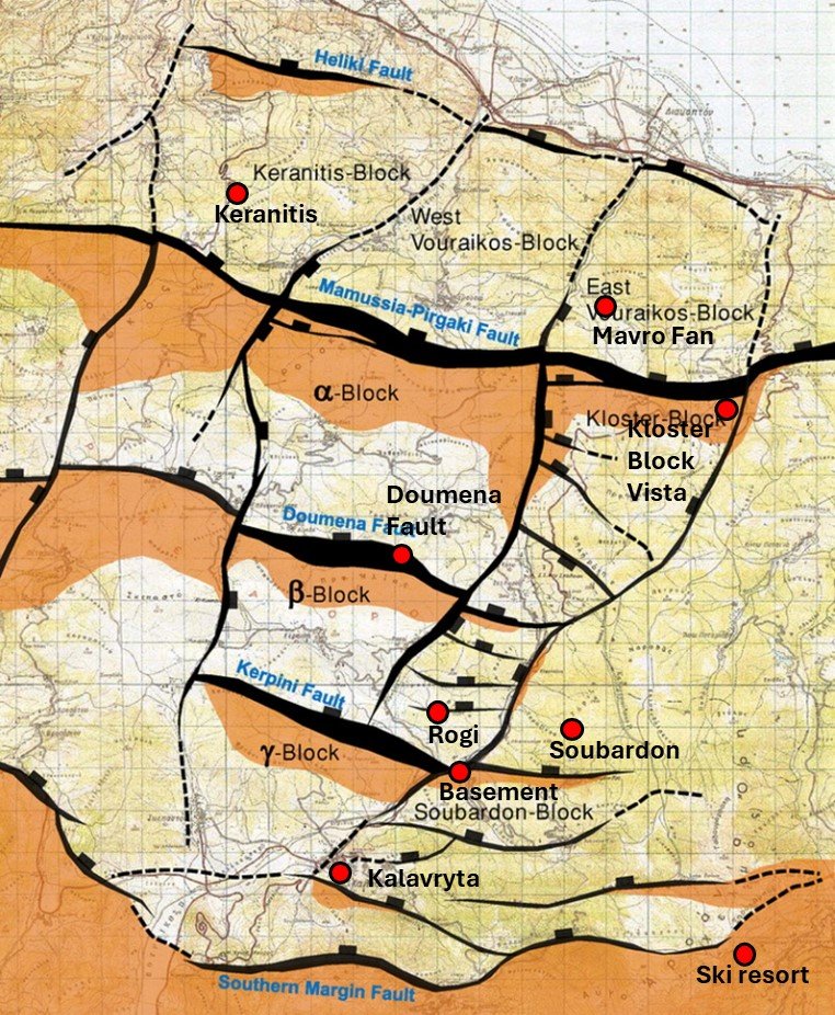
A map of the field work area on the southern side of the Corinth basin, on the northern side of the Peloponnese peninsula. Courtesy of Einar Sverdrup, the map is modified from his field guide.

We start at Mount Aroania, also known as Mount Helmos. 2355 m tall, Helmos hosts a ski resort, and the snow still covered the slopes in May. Helmos itself consists of the basement, the footwall to all the fault blocks of the Corinth basin. Note the dark, crude look of the rocks. Then we turn the head around…

…and look into the first of the fault blocks, the oldest of the several hangingwall of the basin. Note the lighter, sand-coloured appearance of the rocks, and the coloured apparent banding, which are the individual sediment beds. The major fault between the footwall and the hangingwall runs in the small valley with the road.

Onto the next fault block. In this view from Soubardon towards the NW, the valley makes a cut, showing the view through a whole fault block. The distance from left to right is around 7 km. The bedding is clear, and the whole block has rotated against the clock in the image. The main fault in its rear end, towards Mt Aroania is just on the left side of the image frame, where this fault block is the hangingwall. The main fault on the front end follows the slope on the right, making this block the footwall for that fault. The hangingwall, the next fault block, is thrown down to the right. Note also the steeper faults and gentle folding, showing how the fault block itself was cut up by later movements.


This is how the basement looks, near Kalavryta: The basement rocks are not the crystalline granites, gneisses etc we Norwegians tend to think of as basement rocks, but late Cretaceous limestones. Hence, the clear bedding in the basement. These limestones were heavily thrusted and folded during the later compression created by the northwards movement of Africa, which has formed the structure of Greece. Then, the crests of the basement blocks were eroded to become the fill of the Corinth basin – or rather, the individual fault-block basins. The boulders, gravel, sand and clay that fill in these basins is thus composed not of pieces of gneiss or granite, quartz sand and clay minerals, but of limestone in various stages of crushing and grinding down. On the lower image, we see the basement footwall to the left and the basin sediment infill in the hangingwall to the right; with the camera (i.e. me) located roughly on the rightwards dipping fault dipping.


The Doumena fault, named after a nearby village, offers a spectacular display of the major fault plane between the second and the third major fault blocks from Mt Aronaia, nearly half-way to the Gulf coast. Here, you can literally walk around two hundred meters across the fault plane itself – or go down three hundred meters if you stumble. So we took care to stay on our feet, moving one foot at a time, graceful movement be damned. The fault plane is not a single clear-cut, plane, but a series of undulating, curved surfaces, full of glide stripes and grooves from the fault movement. These fault planes are just the very latest, and are developed within the crushed fault rocks of the deformation zone. The movement of the fault is estimated to around one kilometer altogether…

…and what happens to the rocks that fall down along such a fault plane? They form a scree. If there is a stream to tumble them, they may get rounded before settling as a conglomerate. The shorter distance the rocks are transported from the origin, the coarser they are, and the more messy the conglomerate. Rocks that are small enough to be carried further by a river will tumble, jumble, and settle when the water flow no longer has energy to carry them. Lucky rocks may be broken down to sand and clay, and travel all the way to the sea (or, in this case, the Gulf of Corinth).
This image shows a conglomerate in the hangingwall of a fault at Rogi. This fault sits inside the second fault block, and is one of the many fault that divides each of the larger blocks in into smaller segments. The conglomerate is a mix of coarse pebbles, both sharp and rounded, and with the space in between filled by finer silt and mud, and cemented the rock.
Note the smaller fractures cutting the rock: The main usually move several times through the millions of years, and the damage can be spread out in the surrounding rock, fracturing it, and then the fractures are again filled with cement…and the merry may go round several times. On the right side of the image, the rocks are draped by calcite cement. Because both the pebbles, silt and mud, and the basement they are eroded from are limestone, the calcite has been dissolved and then precipitated in fractures, in the same way stalactites grow in limestone caves.

The further from the southern basin margin we get towards the center of the basin, the longer sediments have travelled and the more fine-grained they get. Here are gravel-sized sediments of a fan building out towards the north, at Keranitis. The coarse sediments built out in slanted layers, from right towards left in the image. Then, stretching of the basin rotated the fault block undeneath, which also lifted it up, and the sediments were beveled off in the top and capped by a new flow of gravels.

Further down the sediment road, they have became sand and clay. The Mavro fan delta consists of fine sediments that once built out onto the slope of the proto-gulf, as submarine channels that successively cut into each other.

The end of the journey… View from the third block (the Kloster block) towards the Gulf of Corinth. The river has dug its way through the fault blocks through millions of years, cutting out a canyon. In the far distance is a small delta where the river enters the Gulf of Corinth, on the edge of the youngest fault block.
