Time goes by. In geology, lots of time goes by, and it is easy to loose perspective. If we cram the whole history of the Earth into one year, the Cambrian with first higher life, trilobites and stuff, appear in mid November. Dinosaurs appear in the second week of December, and the infamous meteorite whack them out on Boxing Day (andre juledag for Vikings). Humans or something like that – depending on where apes become humans – are two-three hours old. The whole history of human civilization, from invention of agriculture to space travel, the wars from axe to nukes, from stone tablets to iStuff with half-eaten fruits on? Around one minute.
Here in the southern part of Norway, we cannot brag about rocks from more than the last third of this long time. And, as an oil geologist, I usually lump those rocks together as “crystalline basement and therefore not interesting” – or, simply, “old”. But the basement of south Norway is actually the result of around one billion years of geological crash and bang; of three episodes of mountain building after each other.
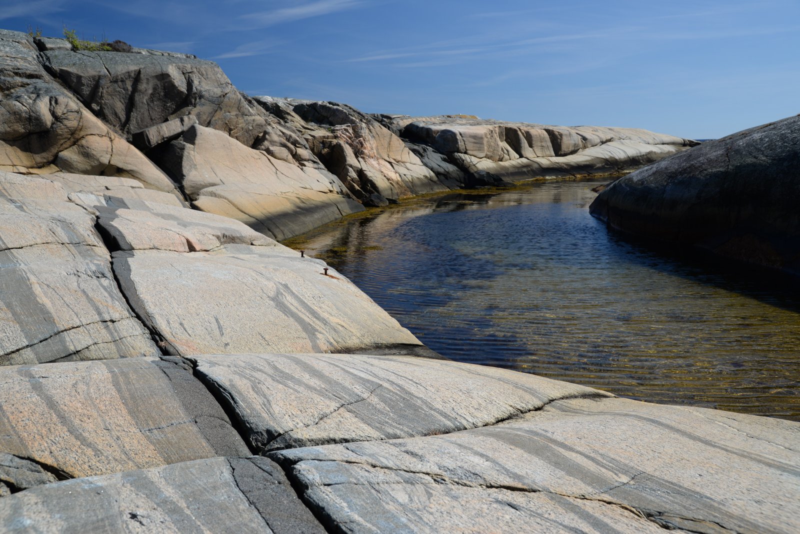
In May, I went to Portør to enjoy spring above and below water, with my friends in Vippetangen Diving Club. Portør, on the coast outside Kragerø, is one of those pittoresque places, which once were the home of fishermen with a hard life, but now consists mainly of city-dwellers’ cabins. They rest on the svaberg, the Norwegian word for hard basement rocks, rounded and polished by millions of years of glaciers.
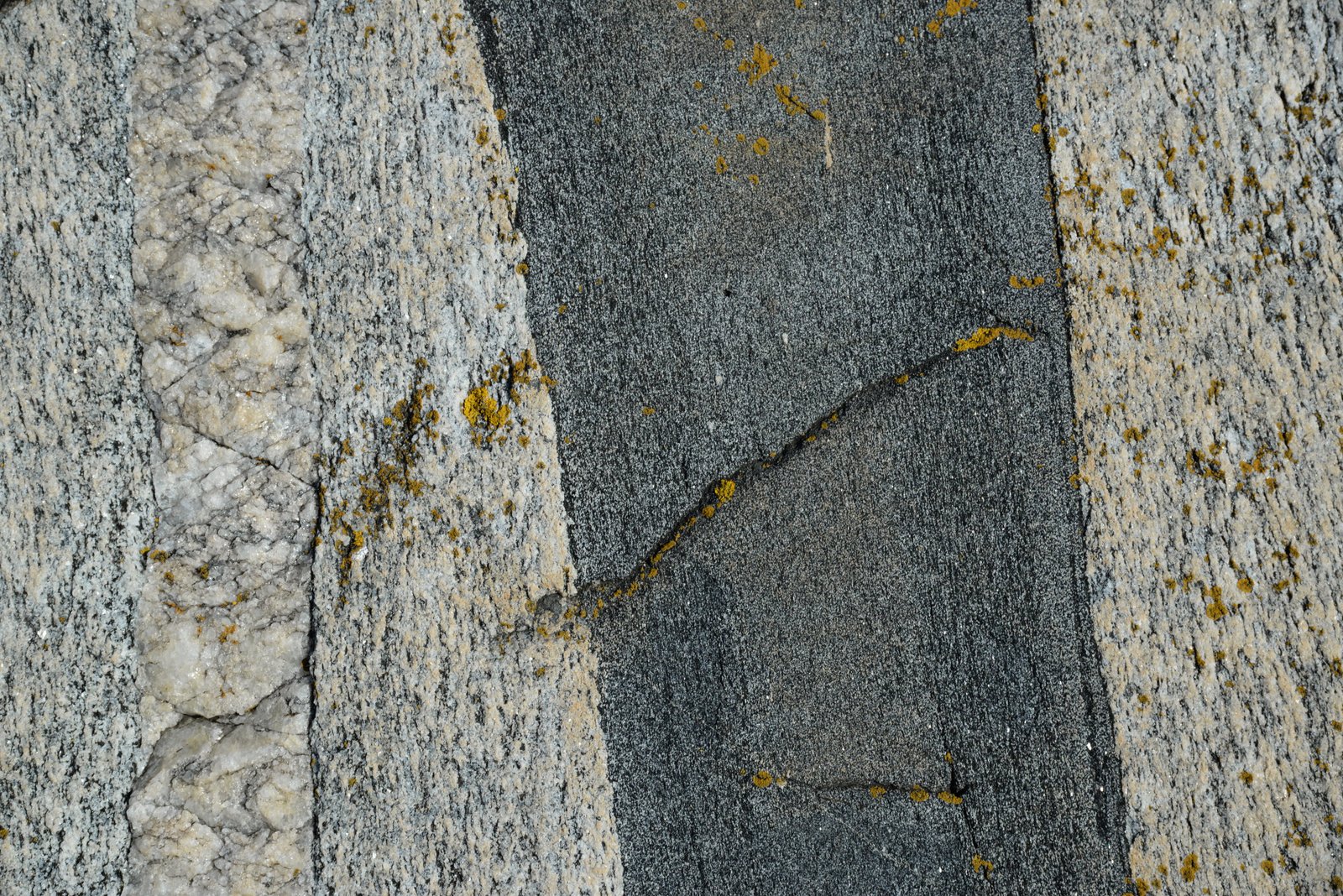
But, let’s start with the beginning of these rocks. Around 1130 to 900 million years ago, this idyllic place was deep in the center of a mountain chain. In geologese, we call it the sveko-norwegian orogen, for muggles, the Swedish-Norwegian mountain building event. We do not know much about it, but it probably lasted at least 200 million years, and was part of a the big event called the Grenvillian in Cowboyland. Today we only find its results as much of the basement rocks of the southern part of Norway, which have radiometric dates clustering around these ages.
Portør would then be calm for around half a billion years. In the mean time, the Caledonian orogeny came and went further northwest; pushing the thrust sheets, which make up much of Norway, up on top of the basement. But in Portør, the next big thing started around 300 million years ago. A rift opened from Skagerak up to Mjøsa. Volcanoes along the rift poured out lava and filled into the trough, with layers upon layers, at least one kilometer thick. Then granite and syenite plowed their way up from below, as big blobs of molten rock. Outside these plutons, dark veins of volcanic rock, dikes in geologese, pronged into the older rocks.
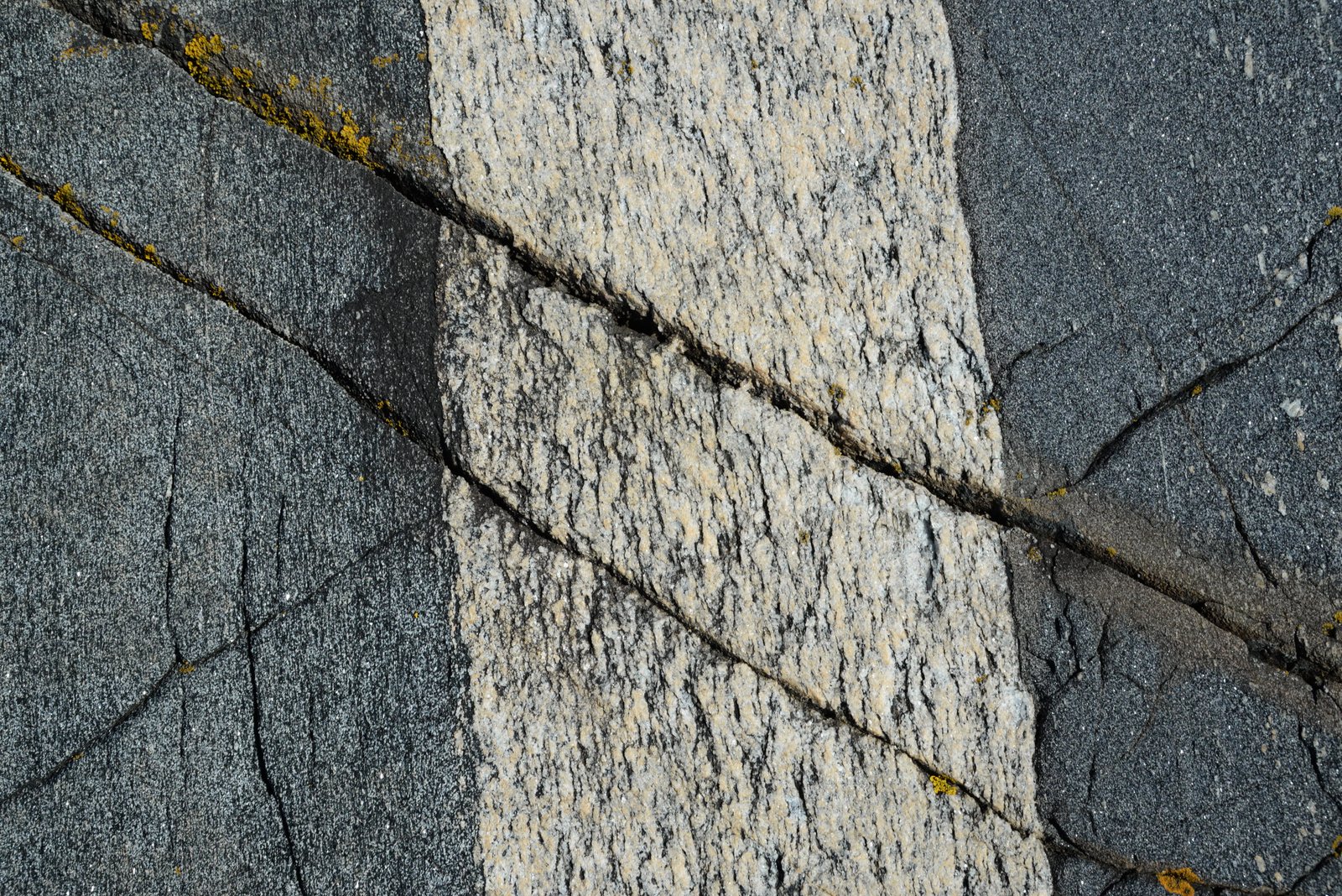
Portør is just outside the “Oslo Graben”, as the rift is called by its proper name. Many dikes, however, found their way into rocks along the flanks of the rift, and, it seems, also in Portør.
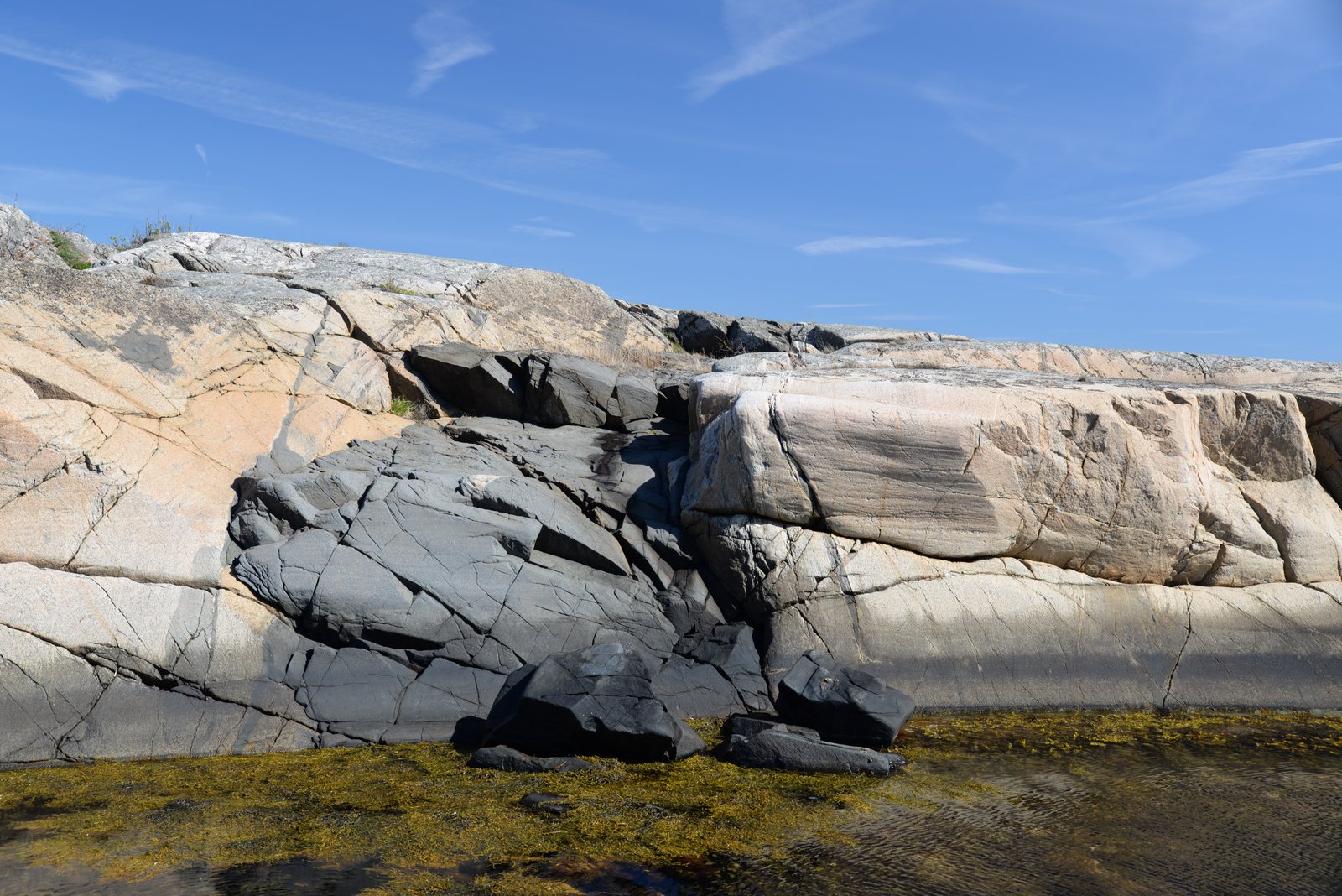
Dark mafic dike cuts the light Precambrian gneiss. Snce I did not carry my Radi-O-Metric hand dating device, I cannot say for sure if the dike is Precambrian or related to the Oslo Field.
If the rifting had continued, Norway might have split along its length. But instead, the rift jumped westwards, and opened what we today call the North Sea during the Triassic and Jurassic. Then, the stretching gradually moved to the west again, and opened the North Atlantic along its current axis. The North Sea became what we called a failed rift – a rift that never succeeded in becoming an ocean – and the Oslo graben was even more failed: It never even became a proper sea.
Fast forwards another 290 million years or so, until a few million years before now: The ice ages. Glaciers covered northern Europe, retreated and advanced as the millennia went by. The glaciers picked up rocks and boulders, which acted as huge abrasives on the rocks below. Following weaknesses in the bedrock, the glaciers carved out the Norwegian landscape, which is such an important part of our indentity, and which we advertise to tourists: The deep fjords, the valleys, are carved out by the glaciers.
The Oslo rift failed to create a sea, but it did create a weakness zone, where the glaciers carved out the Oslo fjord. Indirectly, the Oslo rift created the Norwegian capital.
Portør lies at the coast, and the most characteristic result of the glaciers is the rounding off of the rocky coastline. The rocks are smooth, almost looking soft. During the summer, they are the perfect place for sunbathing. We call them “svaberg” in Norwegian – a word meaning sort of “smooth rock”, but which is so Scandinavian, it has no direct translation.
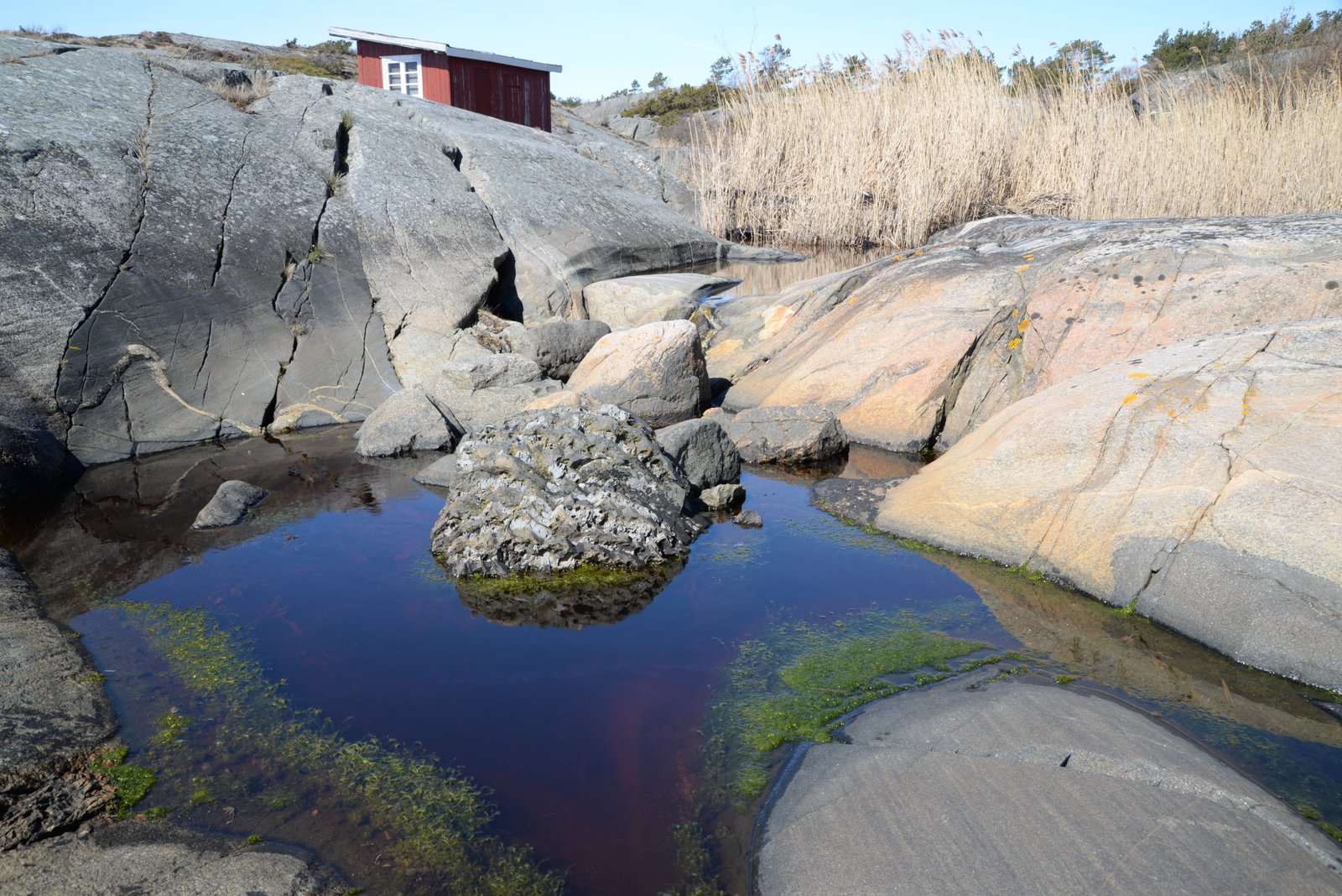
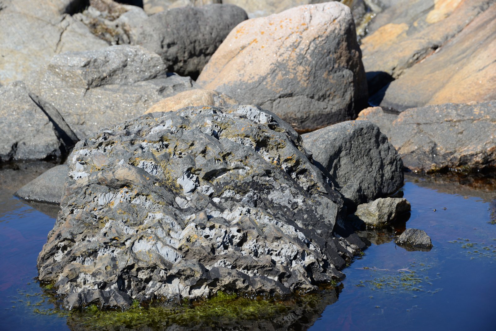
I called it “The Stranger” – a boulder of Lower Paleozoic shale and limestone, carried with the ice from further north in the Oslo field.
The ice, advancing southwards, also carried with it rocks from further north. Strangers, rocks which just not belong here. One such rock is the piece of lower Paleozoic sediments above. While I do not have a precise date of this particular boulder, it is probably somewhere between early Ordovician and early Silurian. It consists of layers of shale and limestone, laid down in a tropical sea, when Norway was just south of Equator, long before the Oslo rift. Most of these rocks were beveled off by the glaciers’ carving, but some sunk down and got preserved inside the Oslo rift – and some got carried away by the glaciers and found themselves in places they should not be.
The images here do, of course, not show the radiometric dating, laboratory experiments and nitty-gritty field work necessary to puzzle the long story together. Nevertheless, I think they show snapshots of how geology is like a forensic detective work, with Sherlocks in dirty boots – the dirtier boots, the better! – digging up clues to our past. And, when the story is put together, we can, quite confidently, state: “This is what happened during the last billion years. Elementary, Dr Rockson!”
