Our journey to the far east of Europe soon comes to an end. But first, a look at something completely different, in age and type of rock. Let’s leave the messy carbonates, more unpredictable as the weather in Western Norway…or ghosts…or cats, as they are, and og back to good ole’ sandstone. 50+ million years older that the Permian rocks we have seen, this sandstone is from the Lower carboniferous (Viséan, for nerds).
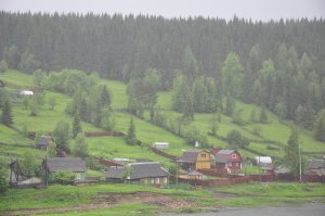
«The stone city» is just East of Gubakha, a city that looks almost like it did during soviet time.
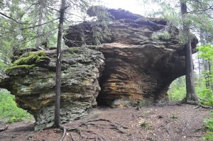
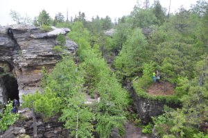
Narrow canyons, steep walls, large overhanging boulders, rock with colours from grey to orange, pink, yellow – the stone city could be a landscape from Star Wars, or from an animated move about dinos. Except that dinos still were a hundre million years away. In the dark, foggy fall, a perfect place to make a really scary movie. Or to go bouldering. I wish I had brought my climbing shoes.
How did it form, if George Lucas did not make it as a prop? The stone city invites to some geo-detective work on its origin. First, how did the rock form, and then, how was it sculptured?
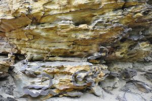
Sandstone makes up most of the rock. A coarse sand, like a solidified beach, except that it displays not wave ripples, but cross-beds: The sand stands in steep layers, like a skewed stack of cards, cut at the top by a erosive surface, then a new stack, new erosive surface…often, the stacks are skewed in different directions, as if a river current had gone back and forth and bent them first here, then there.
And that is what happened: Some 350 million years ago, the sea had not yet reached this area. Instead, a river flowed through the landscape, and carried huge amounts of sand that it laid down, in thin layers that dip in the flow direction.
But rivers don’t float even and gently for long time. Rivers eat themselves. A bit faster flow, during spring thaw, or after just a heavy rainfall, and the river erodes into the sand it just laid down. And then it starts over again, new sand deposition, new erosion…and so, the story goes and can create a thick pack of stacked ex-rivers. Because rivers frequently change paths, eat into their own meanders, run over their banks during floods, then the direction of current may also change, and so does the direction of the card stacks – the cross beds.
Another clue to the origin of this sandstone is the mud – that is almost absent. Big meandering rivers on flat plains deposit a lot of mud on their banks during floods, and in calm parts. But here, very little. The clue is in the sand colour: Pink, orange, yellow, where not covered by grey algae, shows that this sand is from a quite dry climate. And some of the crossbeds are big enough to have been formed not in rivers, but on land, as sand dunes. The river 350-or-so-million-years-ago probably ran through a dry landscape, a semi-desert.

Red, yellow, purple, orange – the warm colours of the crossbeds show that the sand was deposited in a dry climate.
However, another clue suggests that, occasionally, floods or heavy rain brought lots of water: There is some mud in between the shale, and that mud has flowed up like flames and intruded as a network of veins into the sand. Such intrusions happen when the mud is still quite fluid and the sand soft. All the water makes the whole sediment unstable, it collapses and the water ecapes and brings mud intrusions with it.
Then, the sediments settle and have been lying calmly in place until just a few ten thousands of years ago, until Ice came along. The usual suspect for pretty rock formations, glaciers and metling waters from them, carved out the strange landscape. Where hard rocks, from some cementation, rest on top of softer rocks, the ice carved out overhangs and formations that look like toadstools for giants.
This was the end of our Russian geo-journey, through for me new geology and new culture. A country we read about in the news, often disturbing news and with some stone-faced airport officials and café staff. But also a country of great landscape, friendly, warm people, bortsj, pancakes, banja, and top-notch scientists and oil people. When we talk rocks, we are all the same :)
Bye, Misha!


