You know the tourist drill: Charter flight. Cerveza. Hotel, all-inclusive. If on budget in Playa del Ingles, which looks like a high-rise-block working class suburb that someone dropped from the sky into the Gran Canarian half desert. If on higher budget, in Maspalomas or another of the posh suburb-lookalikes. Beach, sun, sunburns, more cerveza, fly home.
But Gran Canaria is so much more than the tourist machines. It is a continent in miniature, with deserts, forests and steep mountains. Join me for a picturesque ride through its landscape, shaped by volcanoes and erosion.

We start in the south, in a desert. Dunas de Maspalomas is like a small Sahara dumped at the southern tip of Gran Canaria. With its light grey-yellow sand, it looks different from the black volcanics that create most of the island. The geo-explanation is that the dunes are beach sand which became a small desert when the beach rose some meters upwards. A perfect place to play Lawrence of Arabia. To admire the small artworks made by wave ripples…
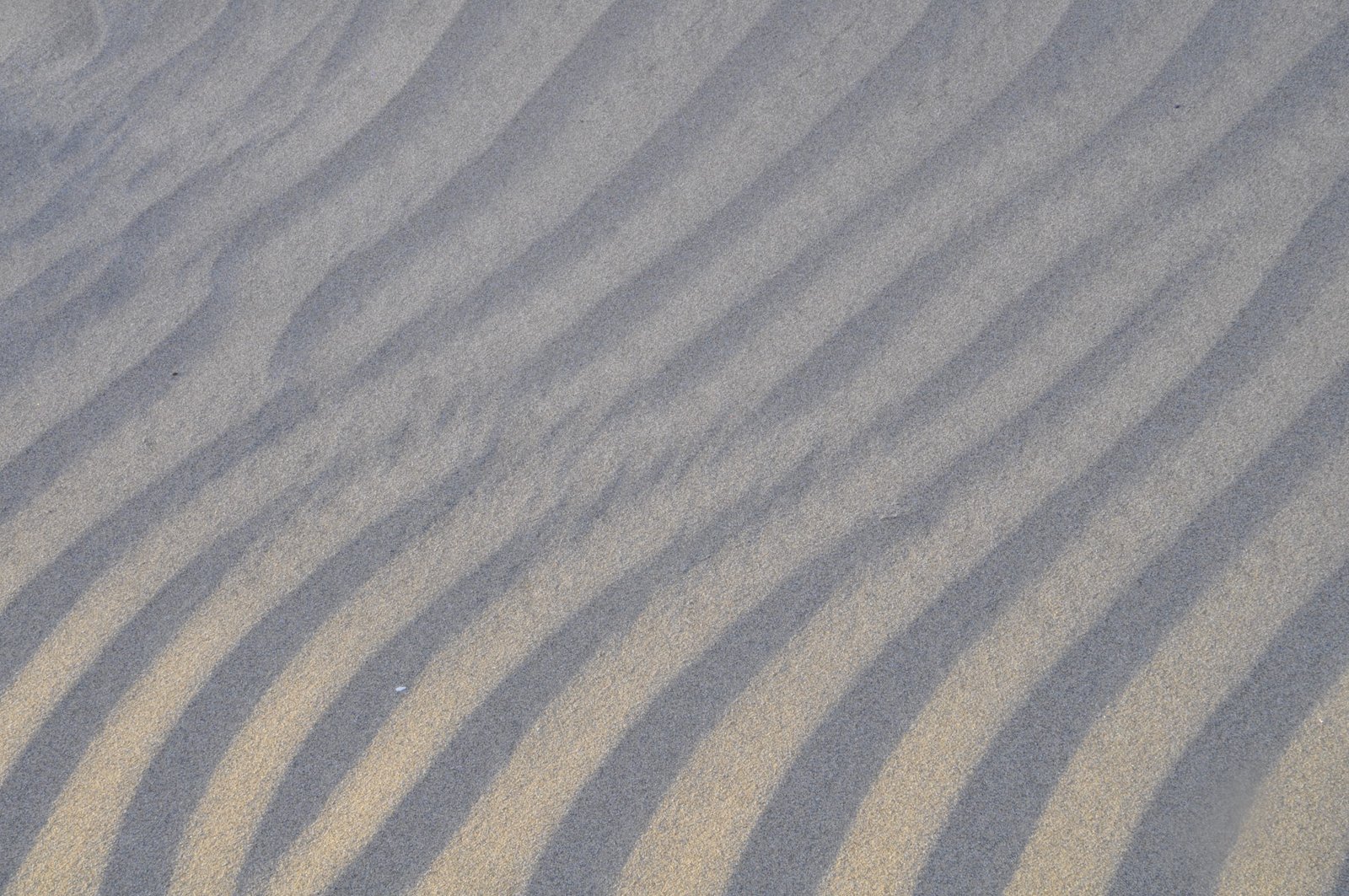
Or just a romantic stroll among the dunes as the sun settles…

Which, admittedly, only allows for a short romance, because the sun sets fast here south.

From Maspalomas, we look into the mountains. With the evening fog around the peaks, they look a bit humbling, almost scary.
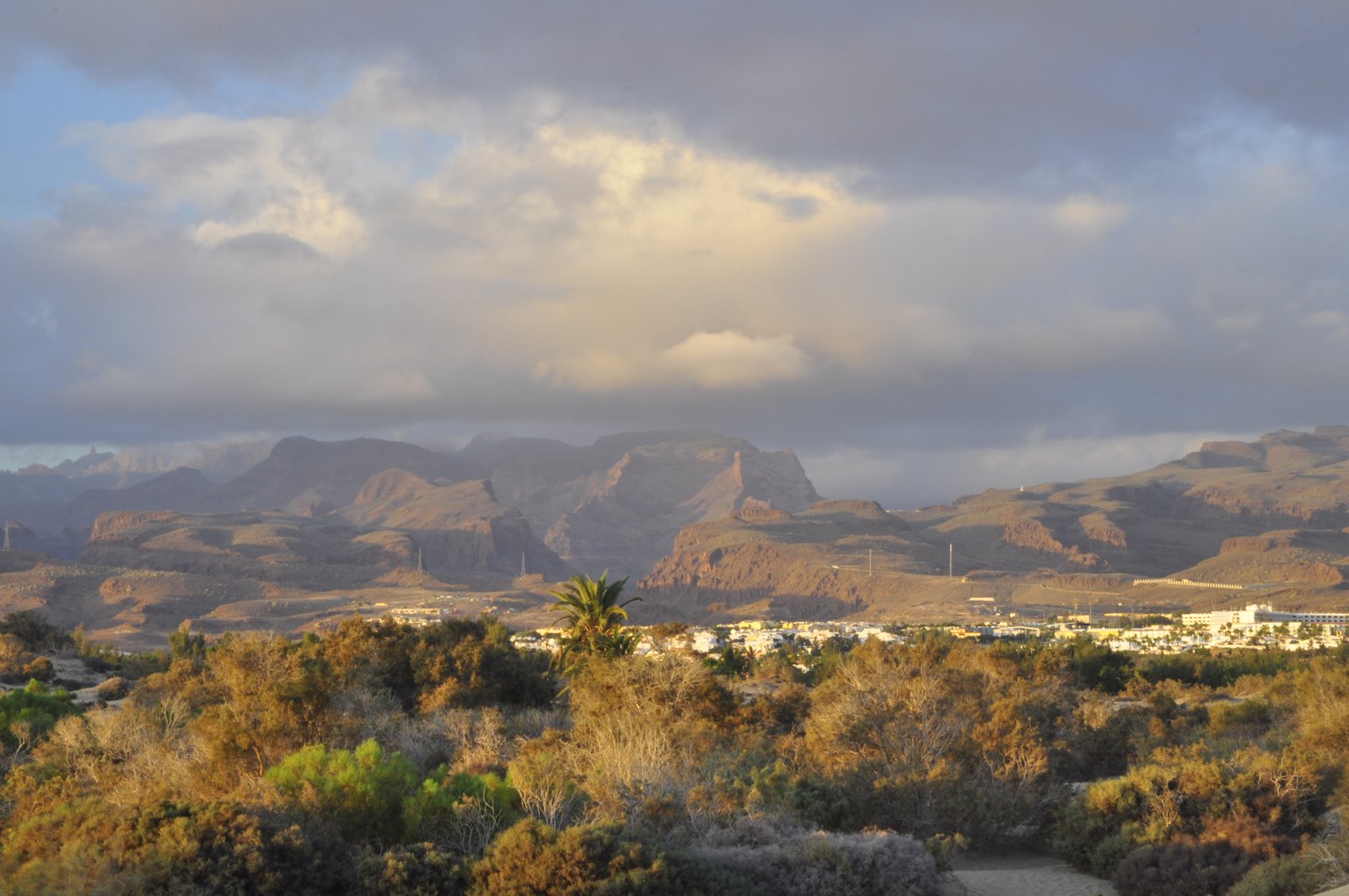
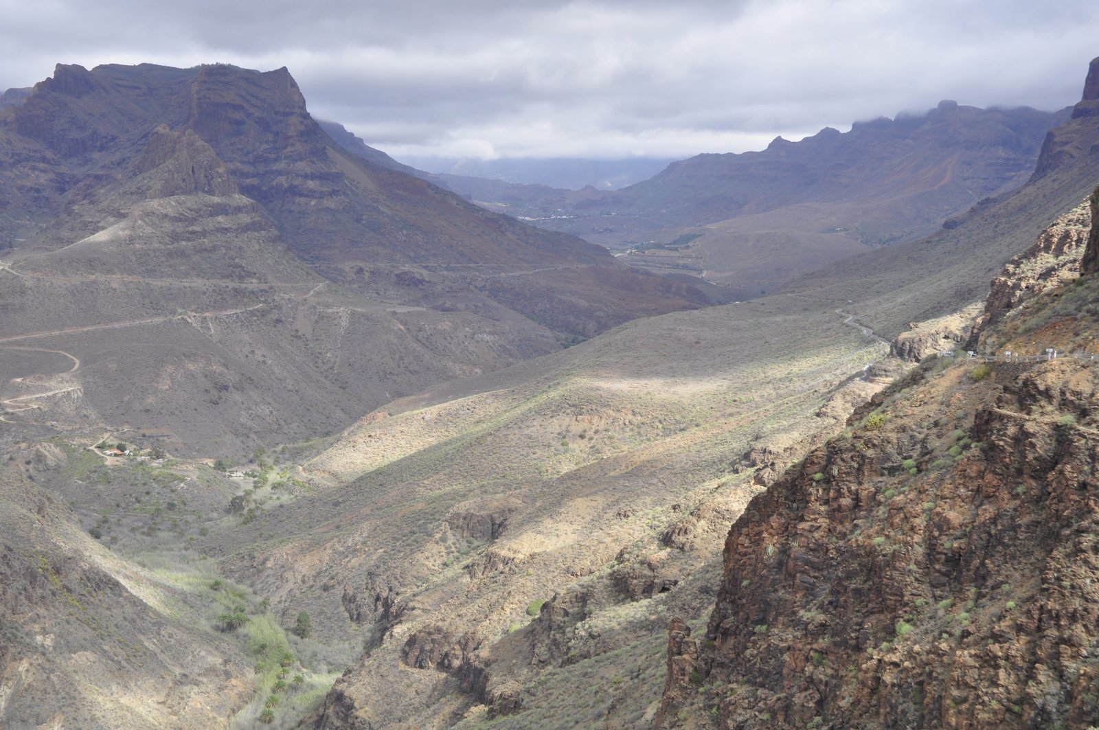
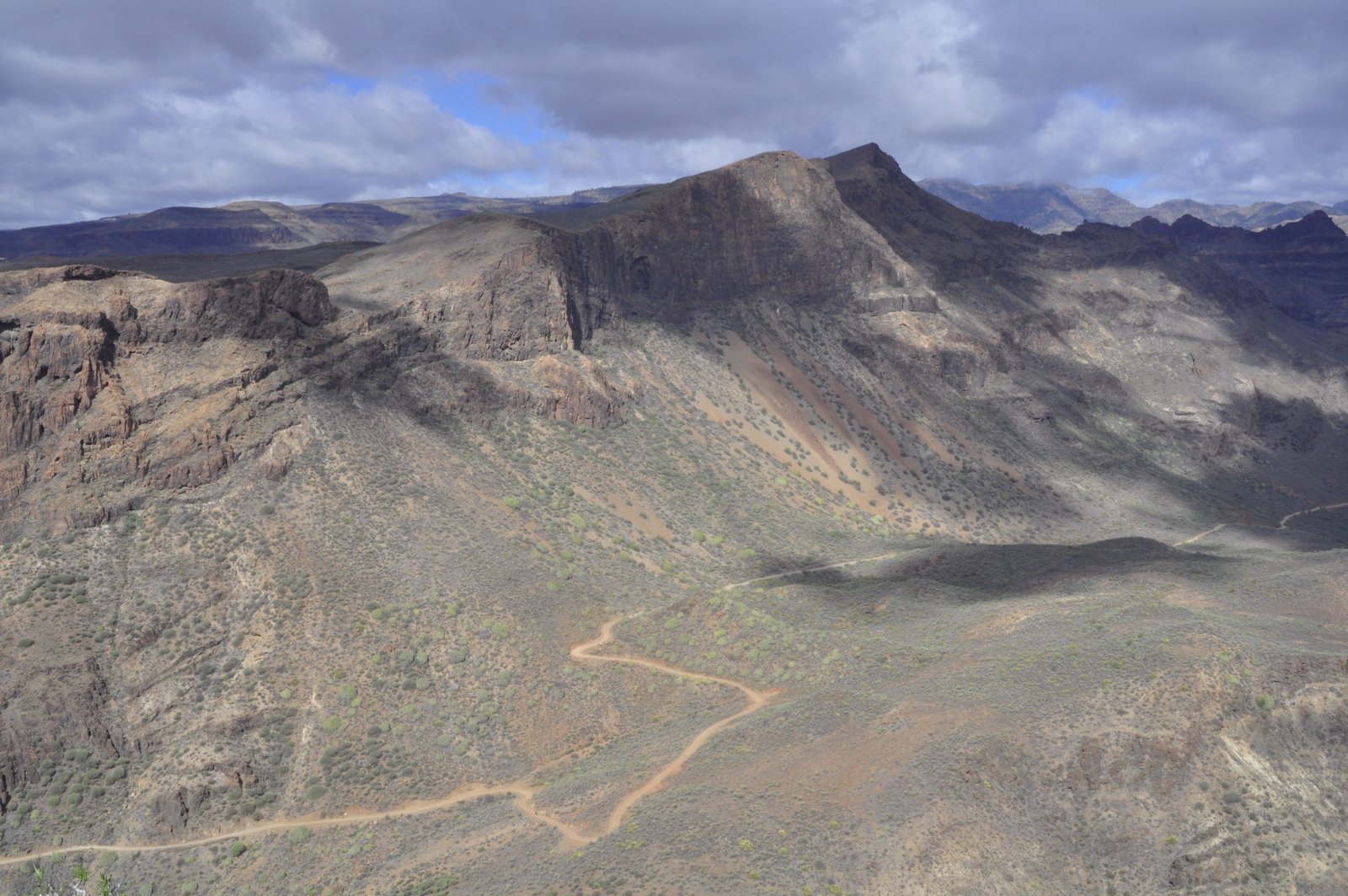
But in the sun next day, the morning fog becomes an ornament, an elegant dress on the mountain’s bodies, with clouds as the hat to protect their pretty face from the sun. We head up and into the steep valleys the barrancos – which strictly speaking mean ravines, because they are so steep. The valley sides often look like they are stacked, because they are: layers and layers of basalt upon each other. Since the volcanism on Gran Canaria happened through millions of years with breaks in between, volcanic eruptions often filled up lava and ash into valleys that had been dug out during the breaks.

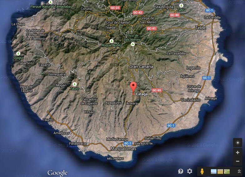
We stop for a quick lunch, tortillas de patatas, of course, in the cute little village of Fataga. A white painted oasis among the dark mountains.


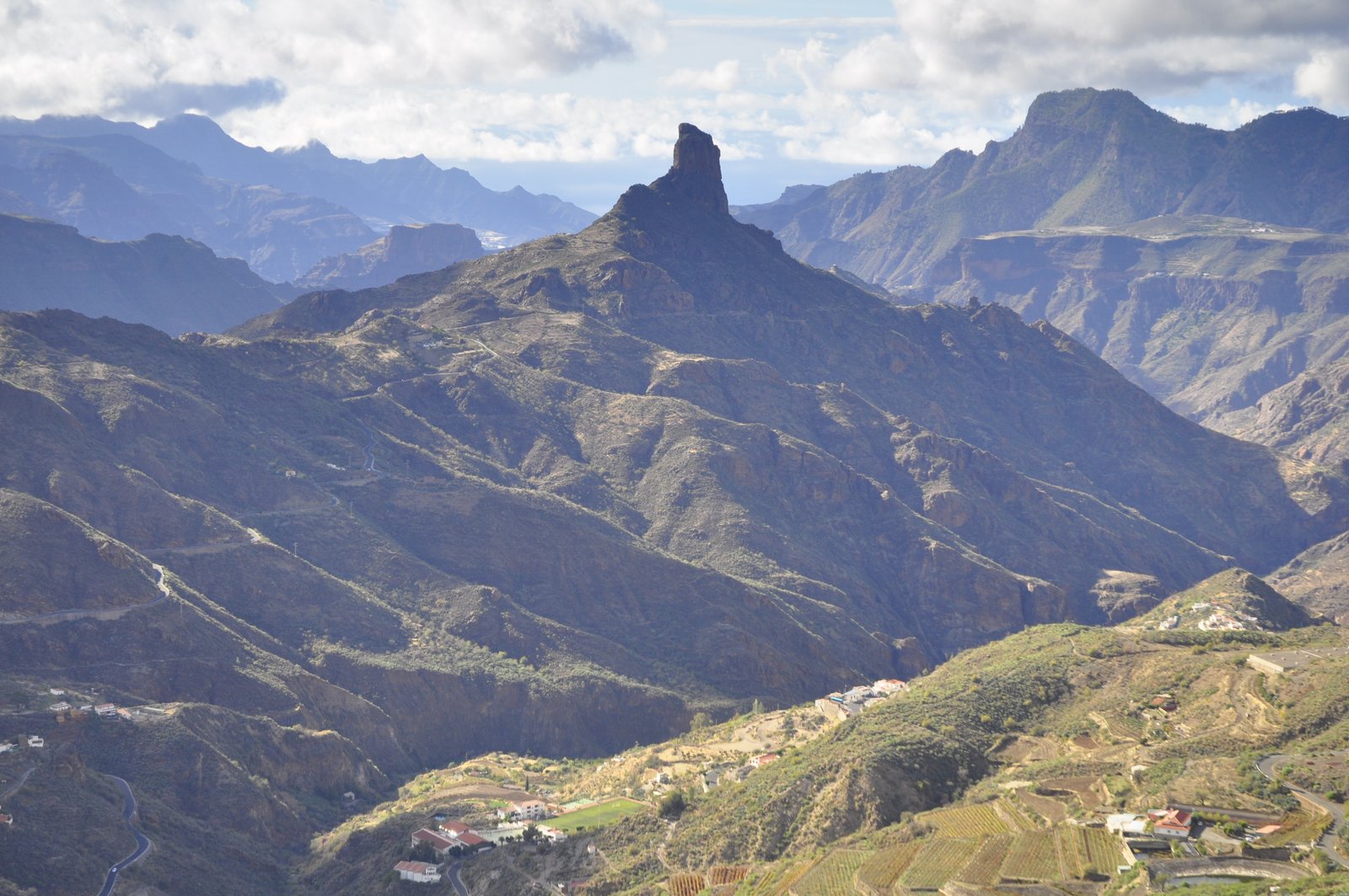
And then, onwards, northwards, higher-wards. I have already told the story of the majestic monolite Roque Nublo. On our way, we pass by another roque, standing as a king in the sun. We wind through mountain roads that feels like driving drunk, even if I am sober like…well, like a driver in the middle of a day.
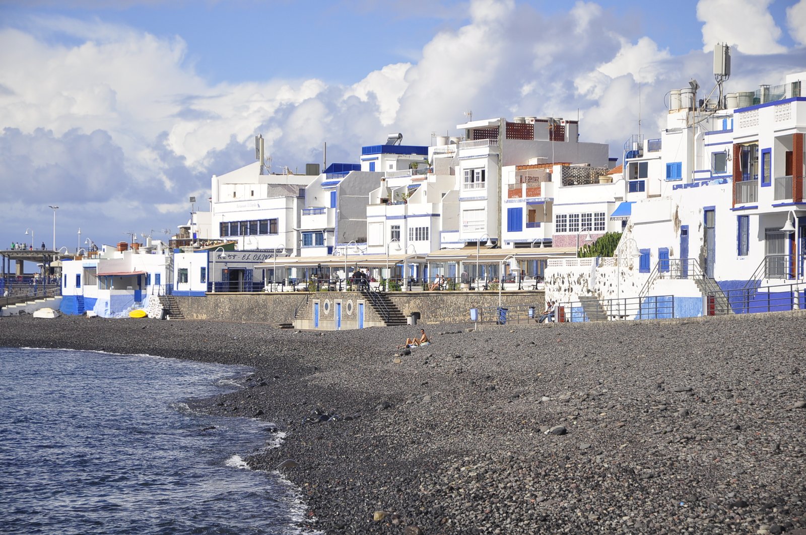
Our crossing takes us to the northwest corner of Gran Canaria, Puerto de Las Nieves. A harbour village in white and blue. May be Greek at heart? Time for ice cream!
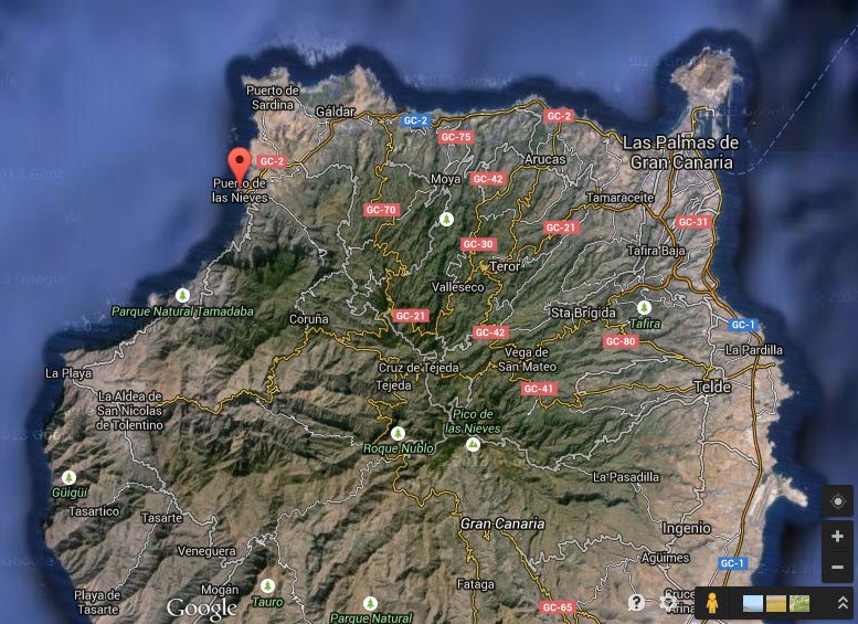
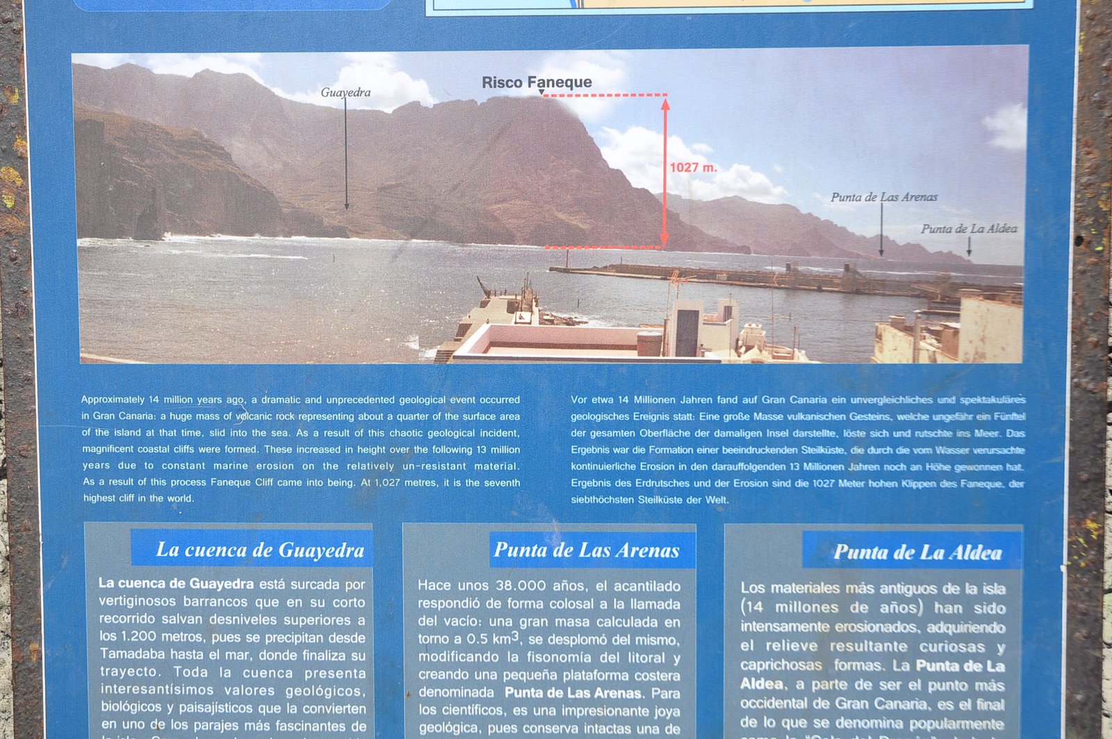
Las Nieves is neighbour to an enormous, steep cliff; Risco Faneque, 1027 meters tall from sea to summit. 14 million years ago, a large slab of Gran Canaria slid into the ocean and left an enormous scar behind. The perpetuos carving by the sea below then created the steep wall. Such walls exist several places in the Canaries. They form when the steep volcanic mountains get undermined by the sea, until they collapse under their own weight and slide down along weak zones, detachments – often soft ash interval.

The whole northwest coast of Gran Canaria plunges steeply into the sea, and the road southwards winds up and down like a worm. But people are everywhere; the village El Risco has almost forced itself into the only almost-flat place in the barranco…


And, with this greeting from the west coast of Gran Canaria, we say good bye to España for this time, with a view from el Risco towards Puerto de Las Nieves.

Pingback: El Teide: The third tallest mountain in the world – and home to the devil! | Adventures in geology - Karsten Eig·