(When you have read this blog post, you will appreciate how lucky we are to have oil!)
During the last posts, I have taken you on a tour along the English Channel Coast. From the wild granite cliffs in Cornwall in the west, to the mighty white cliffs, the Seven Sisters, in the east. This time, we will wrap it up and look at the places – and some new ones – as the steps in what I like to call the “petroleum ladder” – all the factors, steps, which must be in place, in the right order, to form oil and gas. When we finish, I hope also muggle readers will appreciate how lucky the countries around the North Sea are to have oil.
The channel coast is a stretch of beauty, where the wild sea meets the soft beauty of rolling hills, forests and cute villages. And, it is a very good place to understand this force, which shapes so much of our civilization.
Rolling hills, green pastures, the steep white Seven Sisters cliffs – very English!
Let’s start with the recipe for oil: Take lots and lots of dead algae and bury them in the ground for some millions of years. Heat gently to around 80-100 degrees Celsius, and allow to simmer until the algae crack down to long organic molecule chains, and then to oil. If you want to make gas, turn up the heat to over 120 degrees Celsius and allow to crack further. When the oil or gas is ready, the pressure from rocks above will squeeze the oil out. Make sure to have a reservoir ready to fill the oil into, a porous rock which can act as a sponge to store the oil. The reservoir must form a trap and have a tight rock as a lid, a seal to keep the oil in place. Then, be careful to not lift the lid or break the seal so the oil leaks out before you want to pump out the oil.
That’s all there is to it. So simple in theory, but so difficult in practice. And things need to happen in the right order. No good to heat and make the oil, if the reservoir is not there to catch it. So, let’s start with the reservoir, since it also is the oldest of the rocks we will look at on our oil journey.
First stop: Ladram Bay, just east of Exmouth. Time is the early Triassic, ca 240 million years ago. England is somewhere inside the mega-continent Pangaea, meaning “All Earth”. Pangea has been one big land mass for tens of millions of years, but is starting to tear apart, creating rifts and highs. Most of the time, South England is a desert, but during wet periods, rivers flow through the valleys.

Red sandstones, once in a desert inside the mega-continent Pangaea, now home to seagulls along the sea.
How do we know? Much scientific heavy-lifting goes into the Pangea story, but for now: Look at the rocks. Red sand, the Sherwood Sandstone. The colour comes from micro-amounts of iron, Fe2+ – rust! – which shows that these sediments were laid down on land. On closer look, the sands are composed of crossbeds; which form when the wind (or water) grabs sand grains, carries them onto a desert dune or down a river, and then drops them on the silent side of the dune. A thick sand bed thus consists of many thin beds that dip in the flow direction. In between, we can see that there are some shale, likely from lakes or from floods. Often, the shale is even and wide, cutting into the sand below, as could happen when a flood first erodes widely into the rocks beneath, and the shale settles afterwards.

Crossbedded sandstone With shale layers in between, in Ladram Bay.
The Sherwood Sandstone is spread wide and broad, and is a sponge, the main reservoir, in Wytch Farm, the largest UK onshore oil field, which lies just SW of Bornemouth, and whych we wyll vysit again through this story. For now, let’s appreciate how different the reservoir is from image of oil, as black seas in underground caves. The sandstone looks massive. It is only by poking our nose into the wall, we can see that there are tiny pores between the tiny sand grains. But these tiny pores are what holds the black gold.
The shale layers also illustrate why it usually is not just to put a straw into the top of the reservoir and let the money flow. Shale is tight, and creates internal obstacles in the thick reservoir section, especially if they are so wide that oil cannot just float around. Therefore, the wells must penetrate through all the layers of the reservoir to drain as many compartments as possible.
On a more poetic note, the red, yellow, orange colours of the sandstone make for great pictures, glowing in the morning sun. In Ladram Bay, the sand forms mighty red cliffs – and the famous sea stacks, pillars of sand standing out in the sea. Some thousands of years ago, the land stretched farther into the sea. But the sea ate into the land, following faults and weakness zones, and eventually left behind towers standing in the sea. The morning on the top of the cliffs, when the first sun rays appear in the east, can best be described by a cliché: It was one of those times when I felt at one with the Earth and its history. Or, at one with Pandora?
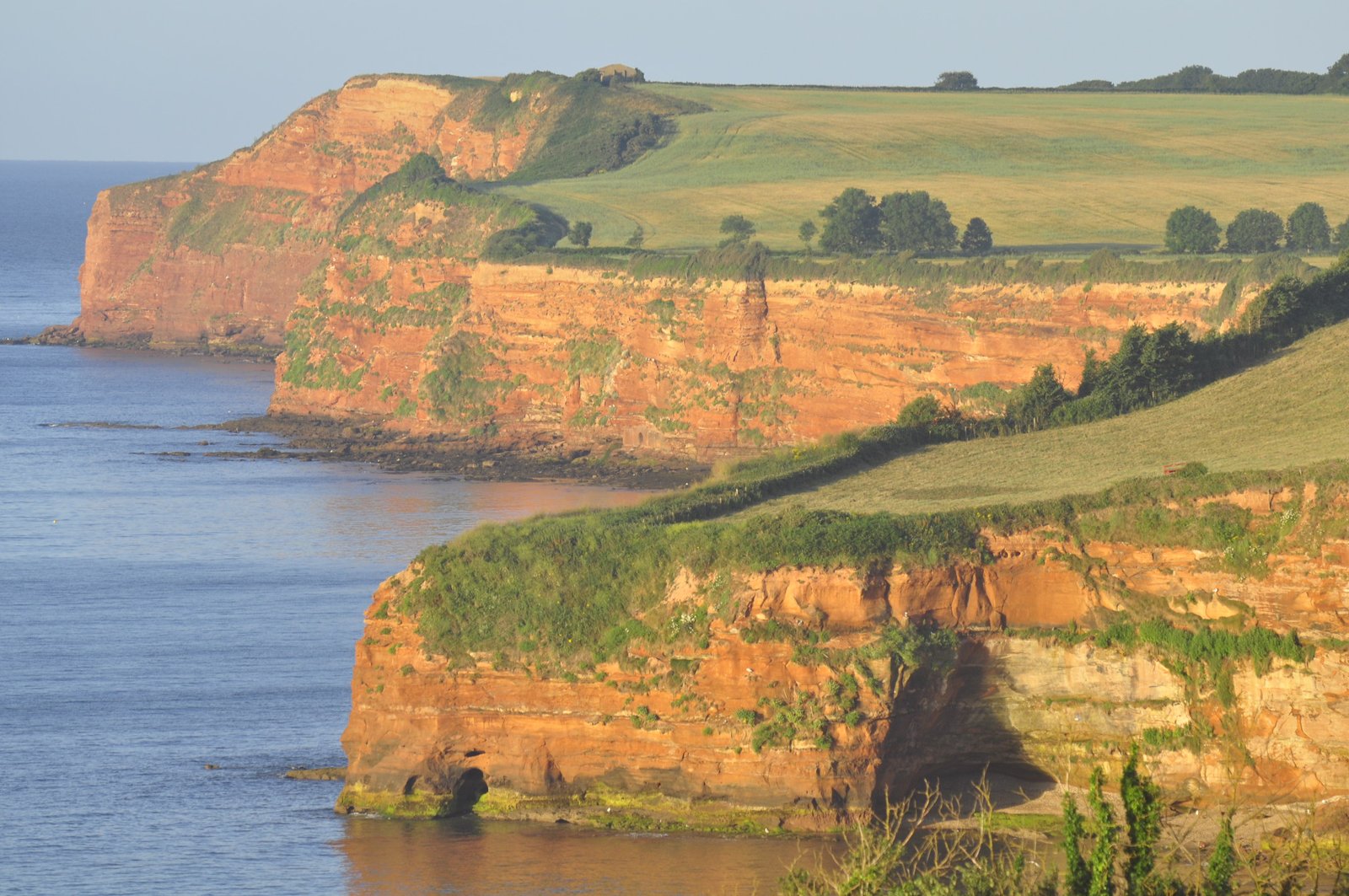

Pandora? Nope, stacks of the red Triassic sandstone, torn out by the hammering of the sea.
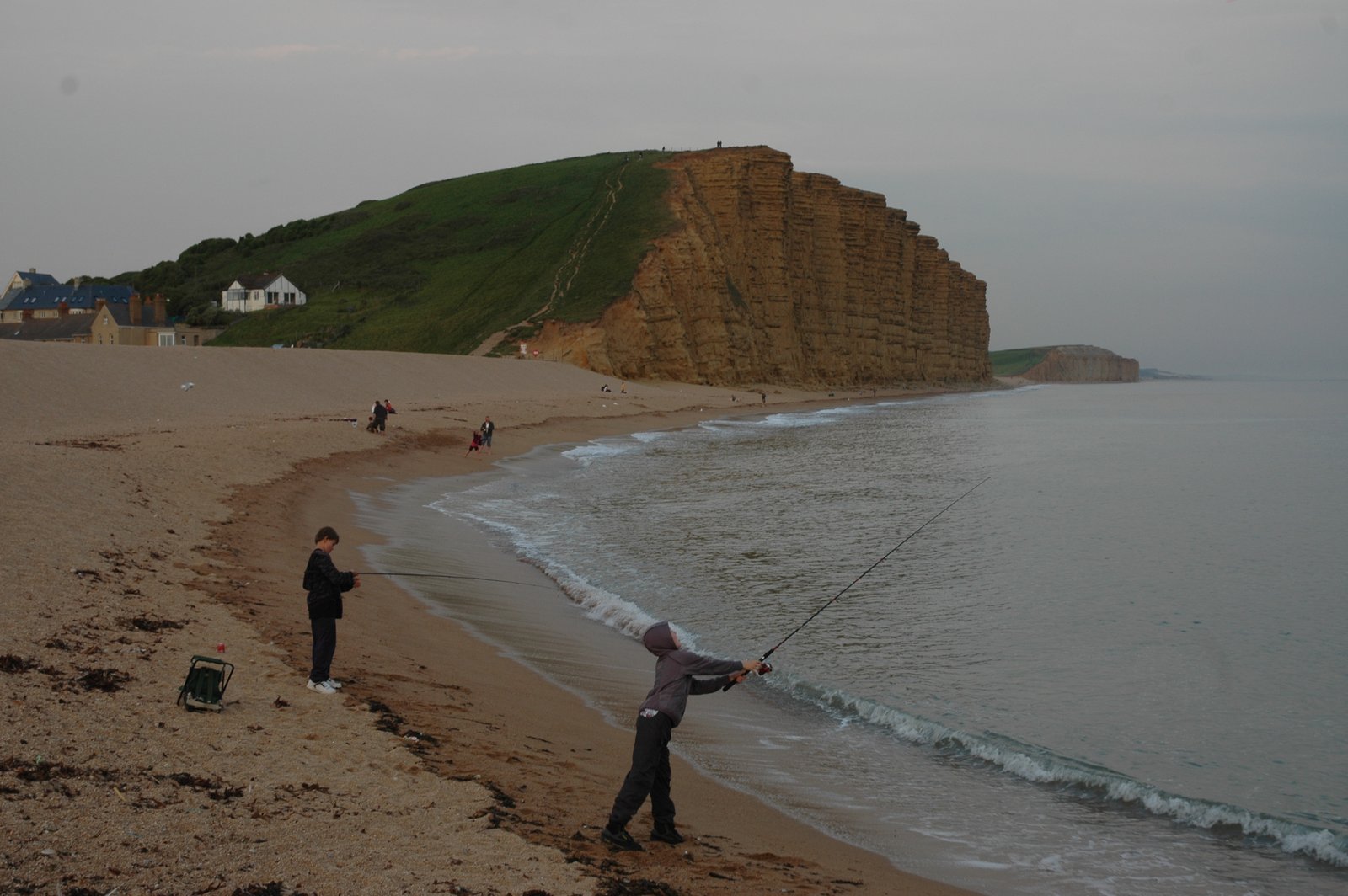
I mentioned that Wytch Farm, the largest UK onshore oilfield, has two levels of reservoirs. So, why not jump up to the next level? We see it at West Bay, west of Weymouth, in another mighty cliff. These are the Lower Jurassic Bridport Sands, and if you have followed my series along the Channel Coast, a new place for you.
The first we notice are the interchanging soft and hard layers. But these are not layers of sand and shale, or limestone. In fact, the Bridport Sands is a big heap of sand, one big, nice sponge. Or, used to be…
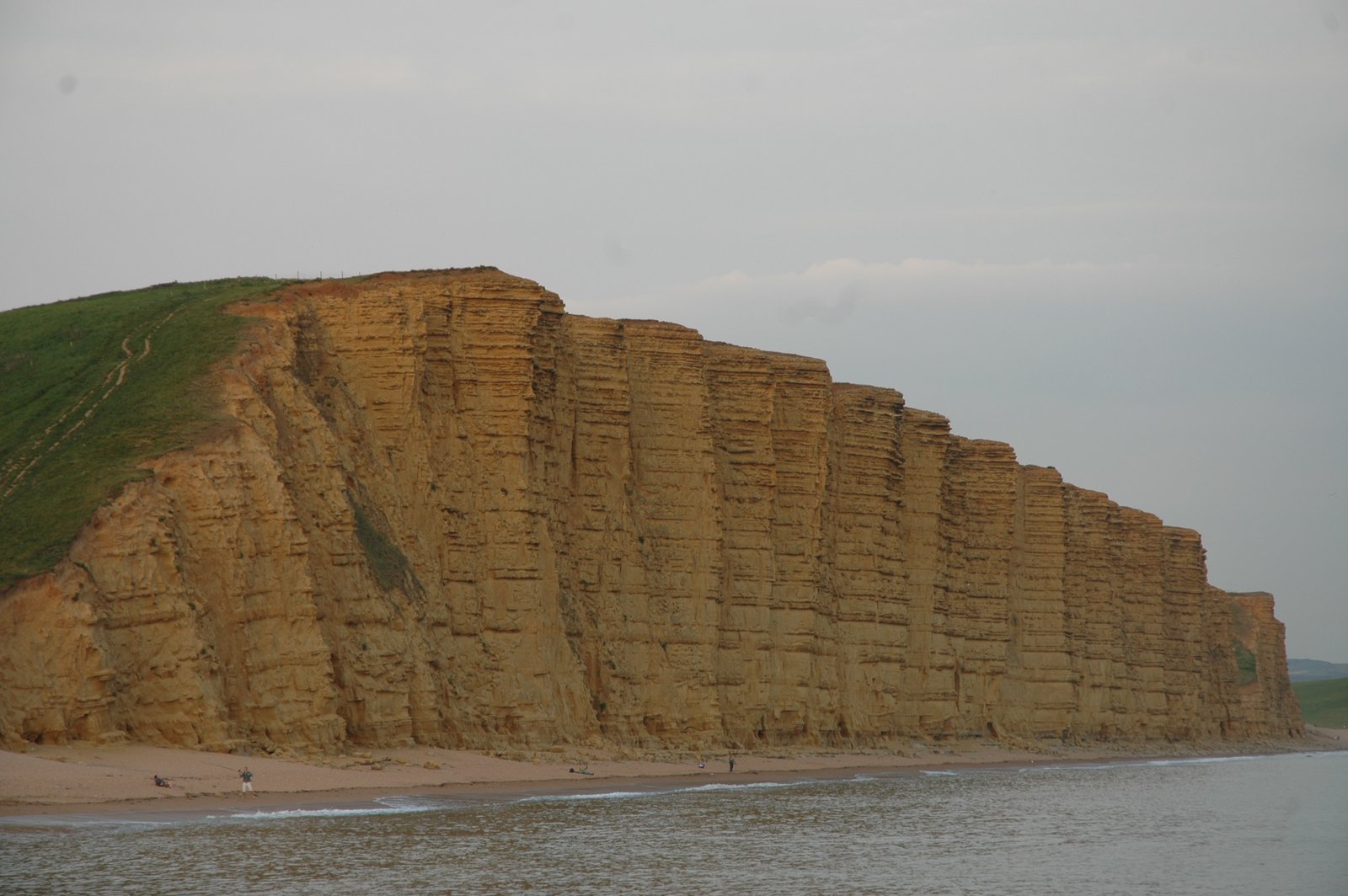
Lower Jurassic Bridport Sands in the cliffs at West Bay, Dorset. Note the alternating soft and hard layers, created by carbonate cement precipitated in the sand.

Geology students for scale at the base of the cliffs at West Bay.
During the early Jurassic, the very early opening of the Atlantic Ocean had started in what is now the Caribbean, the rift had propagated far long north, and the sea had flown into it, and to south England. Here, the Bridport Sands were reworked over and over by currents along a shallow shelf. If the geology gods had been with us, the Birdport sands could have been one big sponge with lots of easy oil to tap.
But alas, after the sands had become rock, layers of calcite cement precipitated from ground water within the sand and divided it into many horizontal segments.

Close-up of the bridport Sands at West bay: Note how the changes between hard and soft are due to the almost invisible cement, not a change in rock type.
The cliff at West Bay is a good example of how important geological field work is to understand petroleum reservoirs. When, in the early 1970s, British Gas contemplated drilling an exploration well on Wytch Farm, they hesitated, because logs from nearby wells did not show any porosity in the supposed reservoir. Then, geologists realized that the cliffs at West Bay, with the same rock, held the truth: It was a porous sand, but with cemented layers that fooled the borehole logs.
Armed with this field knowledge, Wytch Farm was drilled, and discovered, in 1973. Then, in the mid 80’s, BP discovered that the Sherwood Sandstone below held ten times more oil, nearly making the field a “giant” – oil speak for a field with more than 500 million barrels.
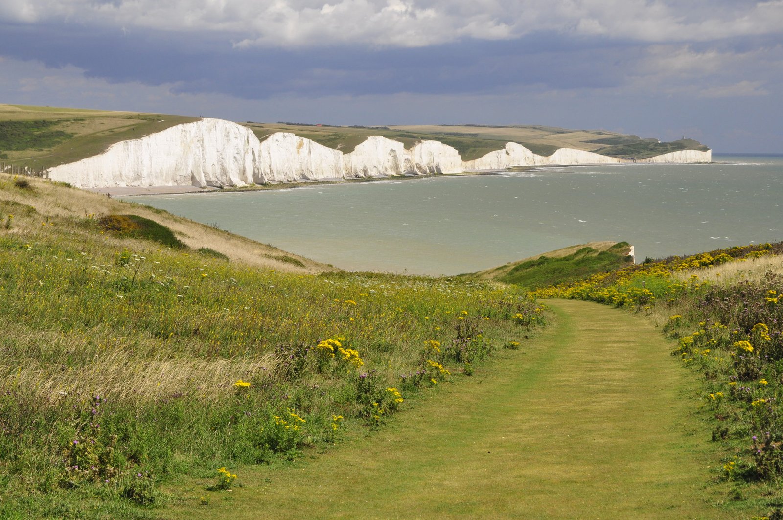
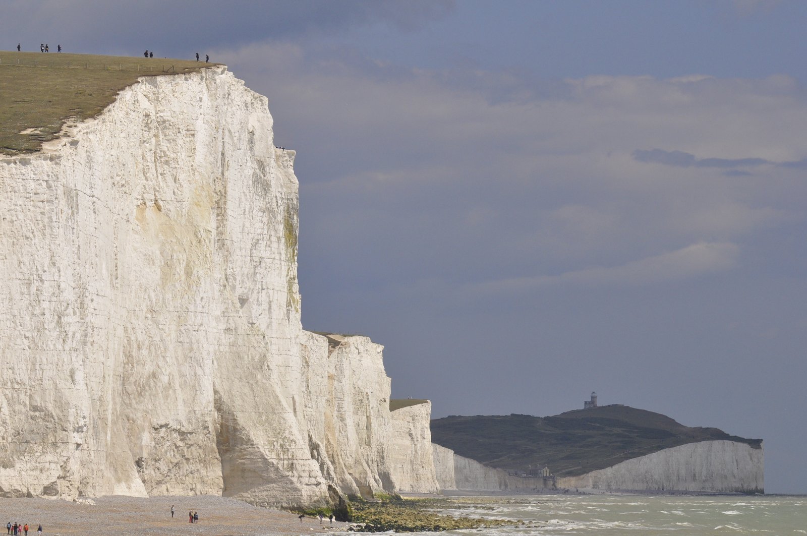
But oil reservoirs are not always sand. They can also be made by living organisms. Coral reefs can be porous inside, and work as reservoirs. Then there are chalks, rocks composed of micron-sized calcite skeletons of microorganisms. We go quite a bit further east, to Seaford east of Brighton, to see them, at the famous Seven Sisters cliffs.
Norwegians would have good reason to pilgrimage to the Seven Sisters: In the North Sea, the same chalk is home to the largest Norwegian oilfield, Ekofisk, as well as Valhall and other fields that altogether contain at least seven billion barrels of oil.

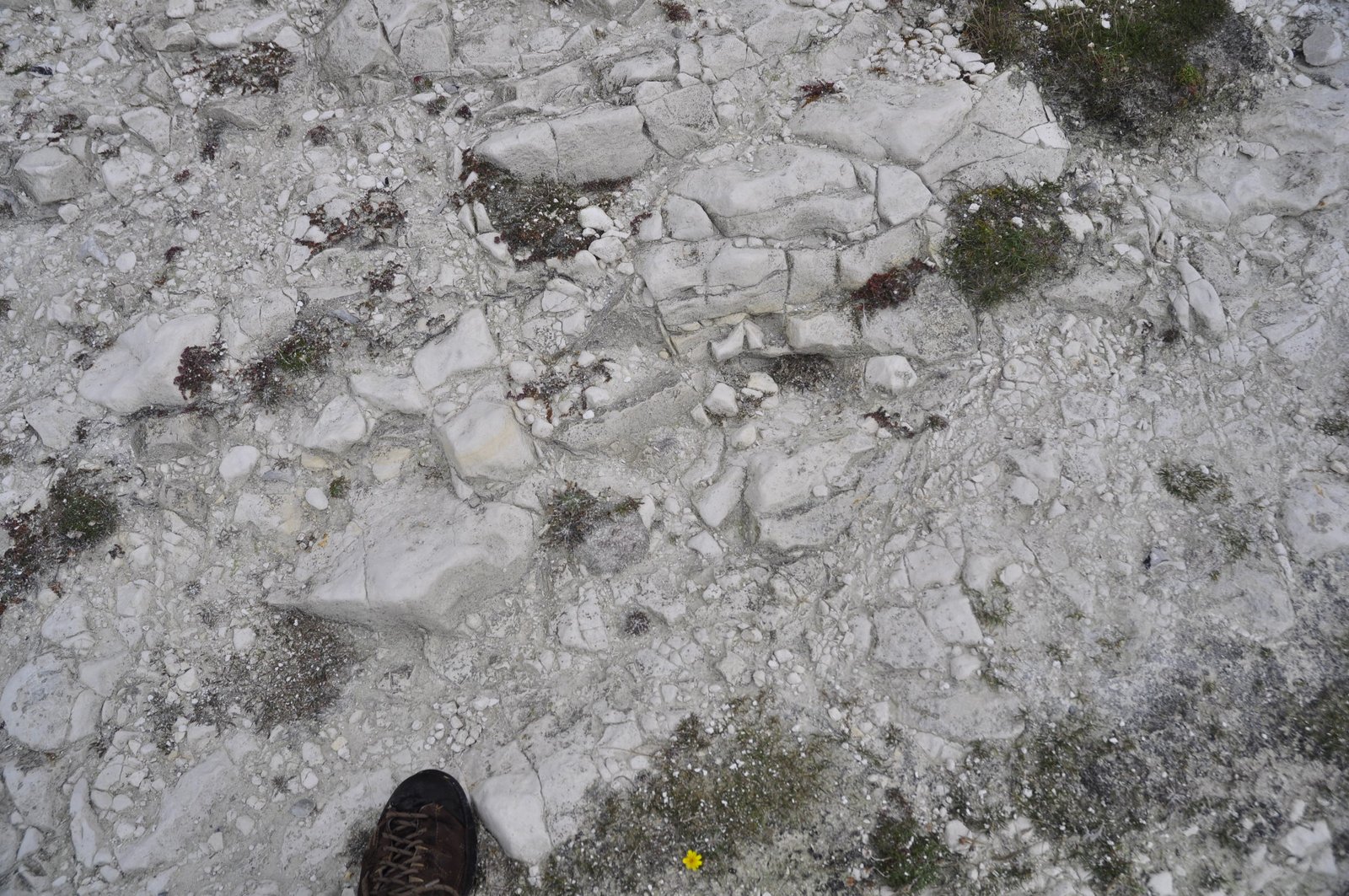
In the Upper Cretaceous, an ocean covered what is now the North Sea and the Channel area, and in it lived zillions of coccoliths, algae with shells like micro-sized frisbees or shields. So many algae bloomed, that the sea must have been white at times. When the algae died, their shells sunk to the bottom of the sea. There, they stacked like an enormous and very porous house of cards. Through time, the cards partially collapsed from the weight of rocks above, which in turn led the calcite to dissolve where the shell edges pressed at each other and then precipitate again in the pores. Bioturbation; digging of worms and creepy-crawlies living in the sea bottom, also messed it up. Up close, the chalk is messy, lumpy, more grey than white. But, still it has kept much of the porosity.
Between the fingers, it feels porous, easily grinding to powder. We easily understand how this natural swamp still is a good reservoir. In the oil fields, it is even more porous, because the oil came in and stopped the chemical process cementing the pores. The billion barrel oil fields in the chalk are extraordinary pieces of geological luck.
So, now we have the reservoir, the sponge to have the oil in. That is actually the easy part. Most countries have some sandstone. But we need some oil to put into it. We need some dead algae.
No, oil doesn’t come from dead dinosaurs. There were not enough dinosaurs. But, as we can see also today, zillions of algae occasionally turn the sea surface into green slime for long times, and when they sink to the bottom can make up a substantial part of the rock .Provided they do not rot. Oxygen is the evil element that makes things rot, so the algae are only preserved if the sea bottom is anoxic. Luckily, the big-scale geology gods have been with us in the North Sea.
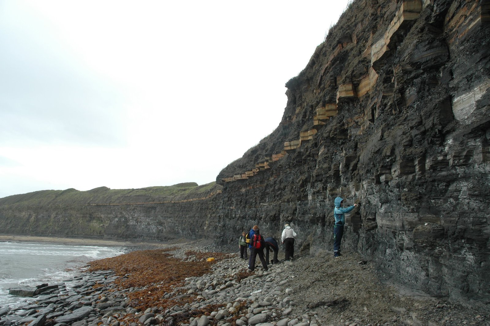
Down by the seaside, geologists poking their noses into zillions of dead algae, now a shale darker than a black cat in a coal cellar.
We move even a bit further upwards in time, to the Upper Jurassic. The infamous rift zone had now split Pangaea all the way where the Atlantic ocean would be. In the North sea, the rift had created isolated basins with little circulation at the bottom. Low circulation means little oxygen at the bottom, which in turn means that organic matter, including algae, sinking to the bottom did not rot, but was preserved and covered by more sediment.
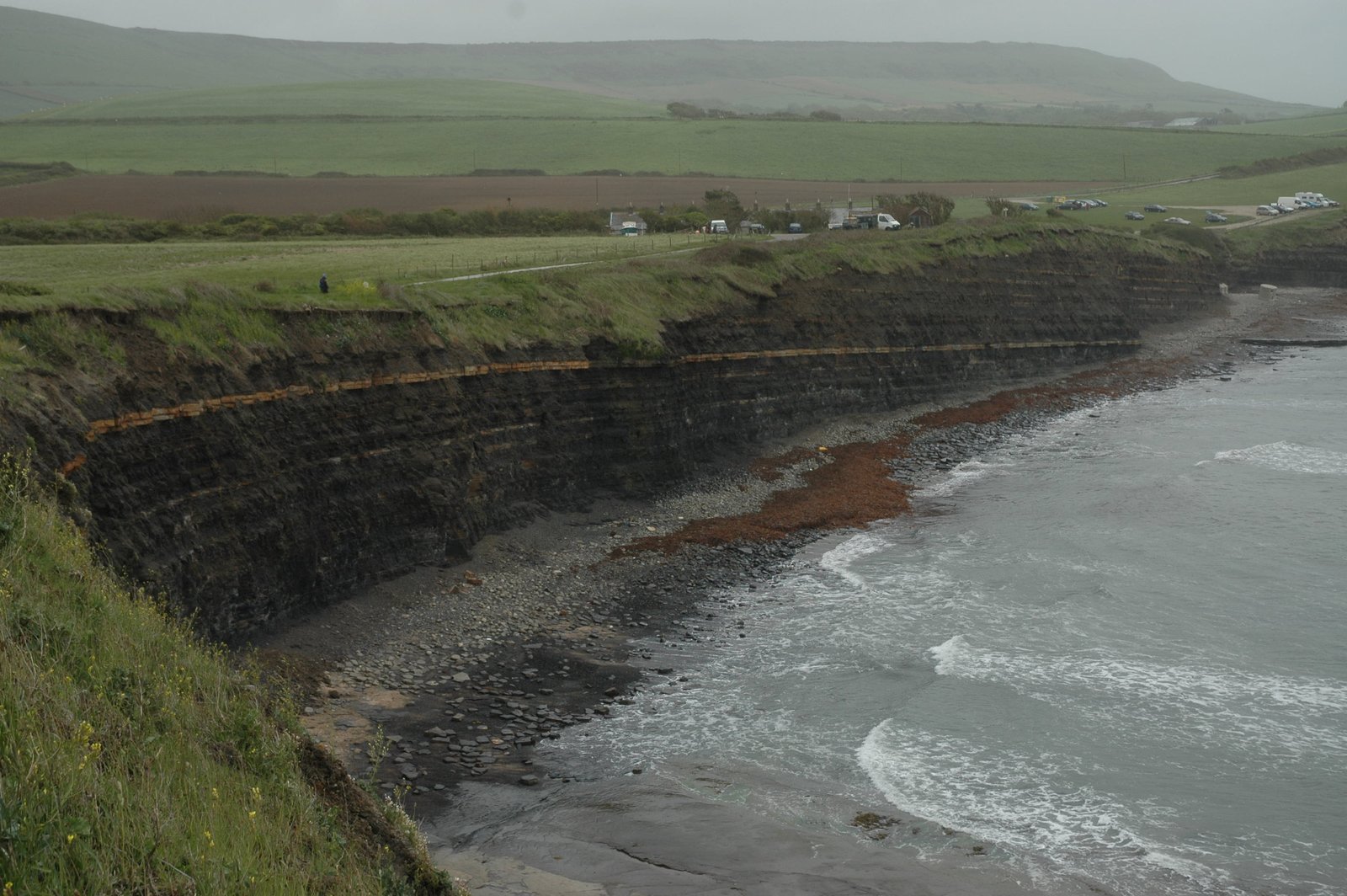
East of Weymouth, in the Upper Jurassic, is probably the closest petroleum geologists get to pilgrimage: Kimmeridge Bay. Name-place for the geological time called the Kimmeridigian, it shows off the dark shale above all shales, the one shale to feed (nearly) all North Sea oil fields: Kimmeridge Clay. The shale consists of up to 35% dead algae in some intervals – or, in geo-speak TOC, for Total Organic Content. But the content varies, and is around 5-10% on average.

Kimmeridge Bay on a sunny day and at low tide. Note the lighter, hard layers; one at the top of the cliff to the right, and another that makes the floor of the beach. These are sandstone layers, a nice contrast to the dark shale. They show how the whole section dips gently, so it is possible to walk up and down through the layers along the beach.
…and a not so sunny day, but with nice, arch-British rolling countryside behind.
In Kimmeridge Bay, the rock hasn’t been buried and heated enough for the final cracking to oil. But parts of it is actually so rich that it burns if put into a fire. And its deeper buried siblings stretch all the way along the North and Norwegian seas, through the Barents sea, and actually up to Svalbard. This black, shitty rock gave Norway a vast rich of wealth, and a good chunk to the UK as well.
(On a side note, the rift later jumped westwards and opened the Atlantic Ocean in its present position. Had the rifting continued in the North Sea, the British Islands might have ended up in splendid isolation somewhere in the Atlantic Ocean, far from the annoying EU, making David Cameron very happy).
So, we have oil and the sponge. Now, we need to keep it in place. Oil is lighter than water, and in the ground it will float up and out, if given the chance. Hence, we need a box with a lid to keep it in.
The lid is easy; it is often the very same black Kimmeridge shale, lying right on top of the reservoir. It is tight; which is why the oil must be squeezed out and into a reservoir before we can get it up through wells.
Other places, younger shale from the Cretaceous is the lid, because the black shale has been eroded away. Or, older, as the shale that caps the Sherwood Sandstone. But, basically shale, black or grey. I trust you get the point.
Our final piece in making an oil field – but, which I unfortunately do not have a good image of – is to have a trap – a box or concealed shape to put the lid onto. The easiest way is to fold the whole rock pack. Give it a good push, a squeeze, so it folds into an arc with the tight seal as roof. This is the most common way to create traps in front of mountain belts.
Another way, the most common along rift zone, is to do the opposite: Stretch the rocks and create, in geo-speak, extensional fault block traps. In muggle-ese, think of breaking the rocks up and tilt them to a row of tilted shoe boxes, with the shale layers as the lid. Just pour in oil, which will collect itself at the top – and voila!, you have an oil field!

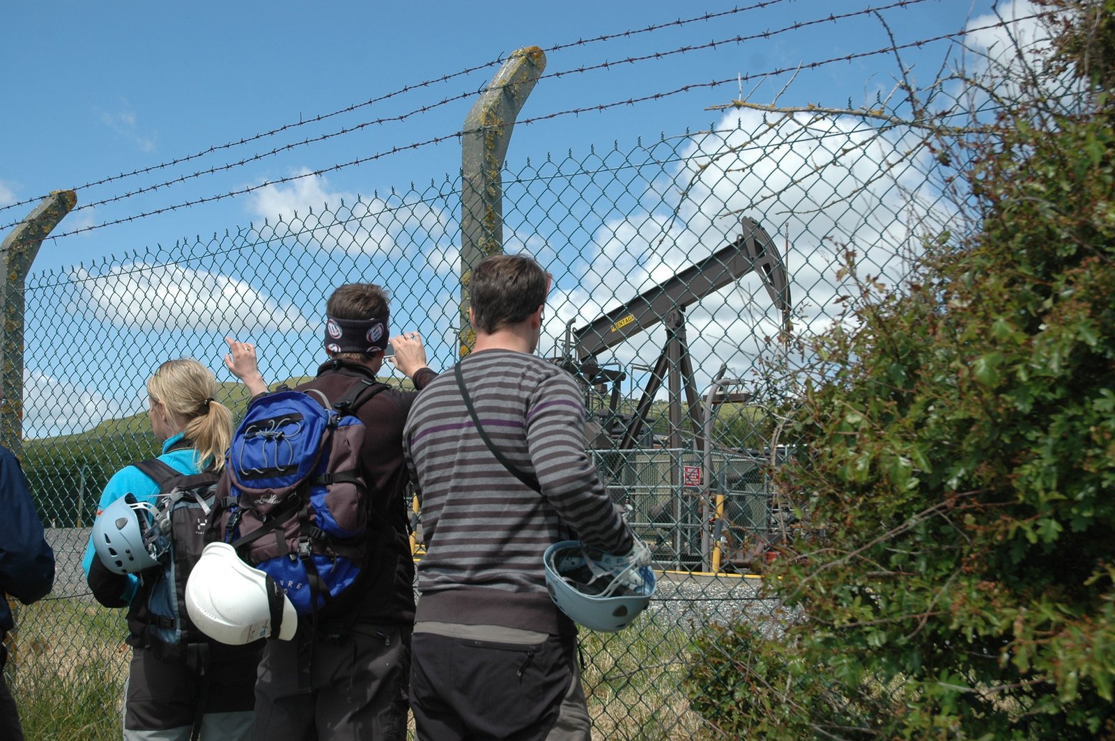
And we have an oil field! This “nodding donkey” pump actually stands on top of Kimmeridge bay. Since 1961, it has produced from a tiny trap beneath the bay, and is the oldest still-going-strong oil well in the UK.
Well…there is more: Timing must be right. The reservoir rock must be formed before crash’n’bang makes a trap of it. And the trap must be in place before the source matures and sends oil into it. Otherwise, the oil just passes by, goes out and away. Or, if the lid breaks, the oil also escapes, like champagne from a bottle when the cork pops.
By now, you see that there are many factors that go into creating an oil field. Making oil fields is simple, but not easy. You need some luck to make and find oil.
So, next time some politician suggests we can pay for something from Oljefondet – “the Oil Fund” – (the Norwegian Sovereign Fund), you can appreciate how lucky we are to have it.
And how lucky we are to keep it – more on that in the next posts!
“Daddy, I want my own oil field for Christmas next year!”