La Palma. The northwesternmost of the Canary Islands: an island with little tourism, but spectacular nature and geology, and it is the site of the archipelago’s most recent volcanic eruption, in 2021. In January 2026, my long standing dream of seeing La Isla Bonita, the beautiful island, finally came true.
La Palma is shaped like a teardrop, with a rounded northern end and a pointed southern tip. This is because the island developed in two distinct phases. The first phase lasted from about 1.7 to 0.6 million years ago. Barely a blink of an eye in geological time, yet long enough to build an island from the ocean floor and stack up three large shield volcanoes. These form the rounded northern part of the island, also known as Paleopalma, “Old Palma.”
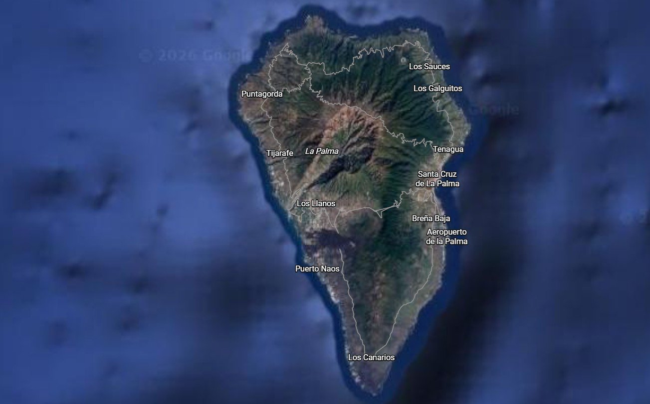
Overview map of La Palma; with the round eroded Paleopalma in the north, and the younger Neopalma at the bottom. Note the black lava flows from the 2021 eruption, between Los Llanos and Puerto Naos.
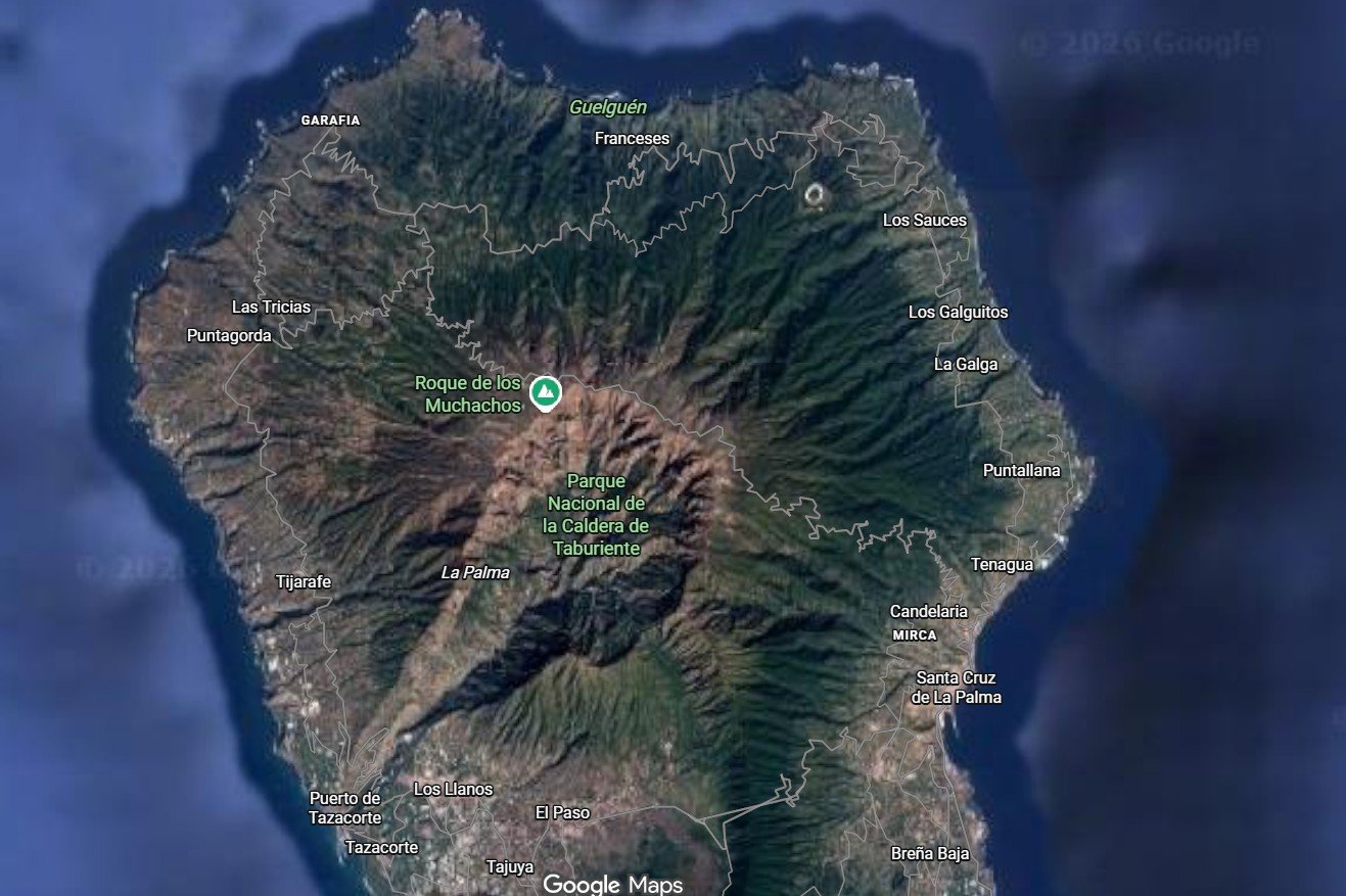
About half a million years ago, part of Paleopalma’s western flank collapsed into the sea, tearing open a huge wound in the middle of the island: the Taburiente caldera, later enlarged by erosion. Despite the name, Taburiente is not a true caldera formed by the collapse of a magma chamber, unlike its famous namesake Las Cañadas on Tenerife.
Since then, erosion has gnawed on at Paleopalma like a giant beaver, carving valleys that make the landscape resemble an enormous citrus press. The roads winding in and out of these valleys and around the ridges make driving on Paleopalma feel like navigating a long strand of cooked spaghetti.
The southern part of La Palma has straighter roads, at least by comparison. This southern section, Neopalma, has formed over the past five hundred thousand years. Compared with the north, Neopalma has a youthful, relatively wrinkle free face. Volcanism leads the race against erosion, smoothing things out. Neopalma is the most volcanically active area in the Canary Islands, with historical eruptions dated to sometime between 1470 and 1492, and later in 1585, 1646, 1677, 1712, 1949, 1971 and, finally, the Tajogaite eruption, livestreamed to the world in 2021.
The lavas from these eruptions lie across the landscape like black and gray rivers of solid rock. The longer time has passed since an eruption, the more ash has turned into soil, and the more vegetation has conquered the new addition to La Palma.
Los Llanos, the island’s largest town with twenty thousand inhabitants, lies in the Aridane valley where Neopalma meets Paleopalma, in the shadow of Taburiente. The town sits on lava from the 15th century. The 2021 eruption struck the outskirts of the urban area, burying three thousand buildings and leaving seven thousand people homeless. The entire village of Todoque vanished beneath the lava. Google Street View in Todoque still shows houses and gardens, where today there is nothing but a black, frozen blanket of lava. if the eruption had occurred just a little farther north, it’s chilling to think that all of Los Llanos could have been wiped out, and there would be nothing anyone could have done to stop it.
View over the sea of lava: the 2021 Tajogaite eruption buried an entire village in the Aridane valley beneath a black, hardened blanket.
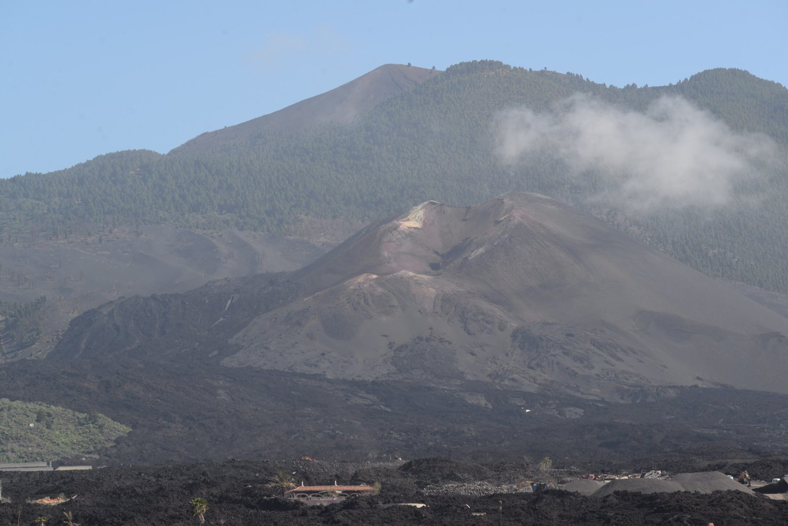
Tajogaite volcano, seen from the outskirts of Los Llanos. Dynamite and bulldozers have taken up the fight against the lava.
My family was kind enough to give me a full, indulgent geo ego day. Up before sunrise, with fully charged camera batteries and empty memory cards. As the sun ascended, the road first led me down into the valley forming the western outlet of the Taburiente caldera. Then it began climbing, up and out onto the island’s northwest side, weaving in and out of ravines and then up, up, up, on roads that would impress even people from western Norway.
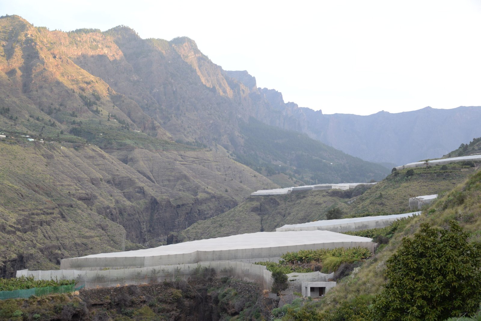
Looking up Barranco de las Angustias toward the Taburiente caldera. The white sheets cover banana plantations.
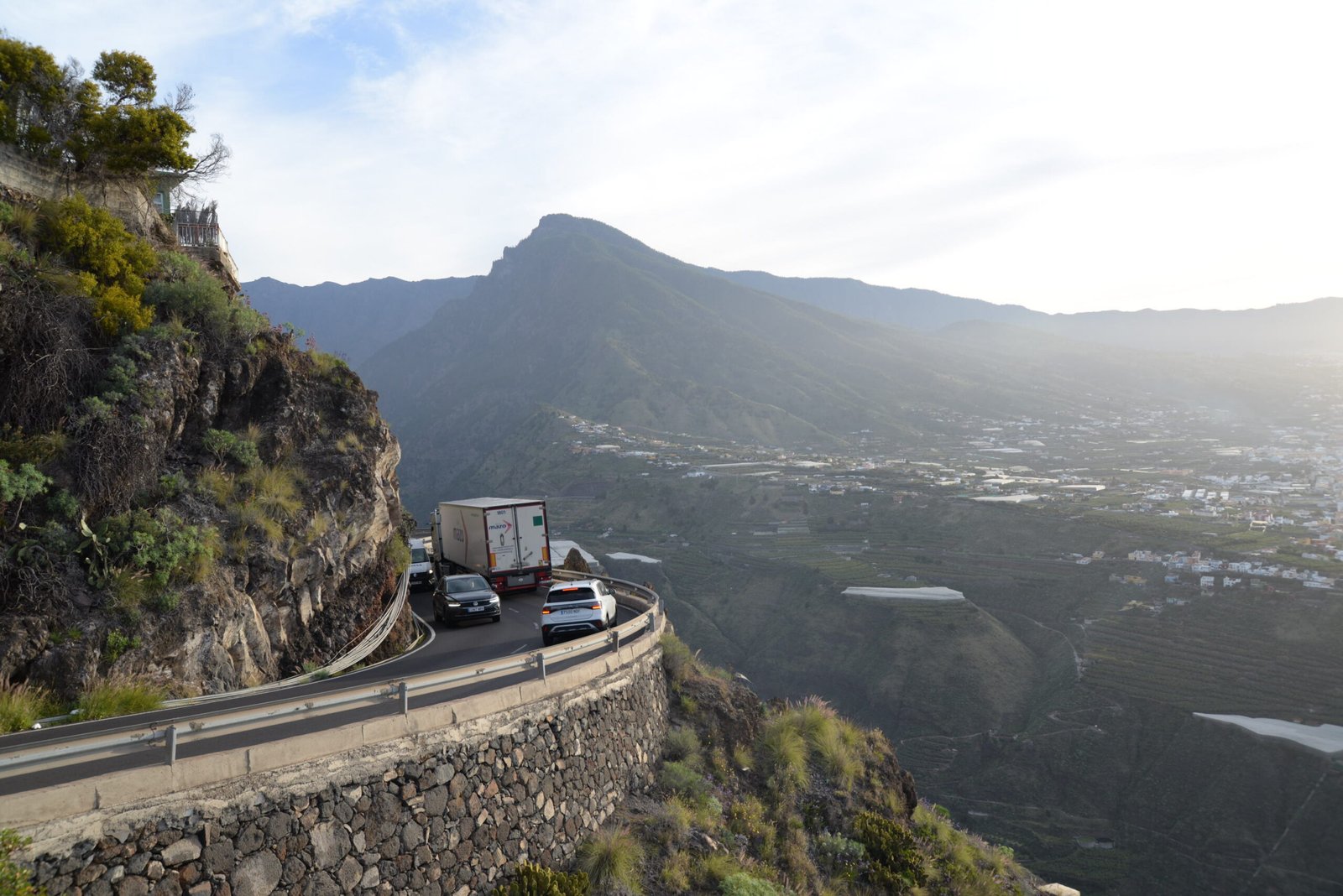
View over Los Llanos, at the edge of the ravine leading up to the caldera, seen from Mirador El Time. The road winds down into the valley and back up the other side.
The subtropical leaf forest gradually gave way to mighty Canary Island pine. This pine blankets the high mountain slopes of the islands. Then came the bare mountains, with only scrub and grass here and there, until the goal appeared: Roques de los Muchachos, 2,426 metres above sea level.
Mordor, with Rivendell in the distance? Harsh and steep at the top, with a lush valley at the caldera floor.
The tiny parking lot was already full. I managed to squeeze the car in along the roadside and prayed to the rental car gods to look upon me in mercy. A little later, a bus arrived. I still wonder how it was physically possible for a bus to get up there. Perhaps bus drivers are magicians?
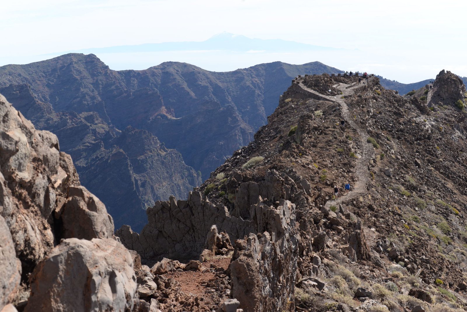
The path to the viewpoint at Roques de los Muchachos feels like walking along a ridge in Mordor.
But the view! Standing at the rim overlooking the Caldera de Taburiente felt like standing on the edge of outer space, gazing down into the abyss of a lost world. A magical place where dinosaurs might still be lurking in the shadows, if only La Palma weren’t about one two hundredth the age of the last dinosaurs. But what action movie director cares about such empirical details?
The Taburiente caldera from Roques de los Muchachos, with a sliver of Los Llanos—and on the horizon, the outermost Canary Island, El Hierro, seemingly floating in the haze.
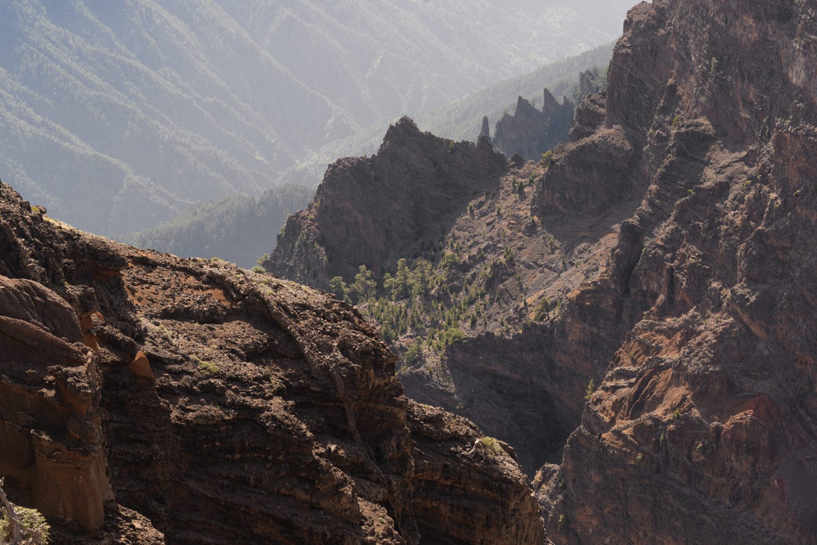
The caldera walls reveal the interior of the vast shield volcano complex that once stood here. Layer upon layer upon layer: a palette of black lava, gray and green ash layers, brown pyroclastic flows, all cut through by dikes, volcanic intrusions from later eruptions. A piece of modern art, created by fairly modern geology.
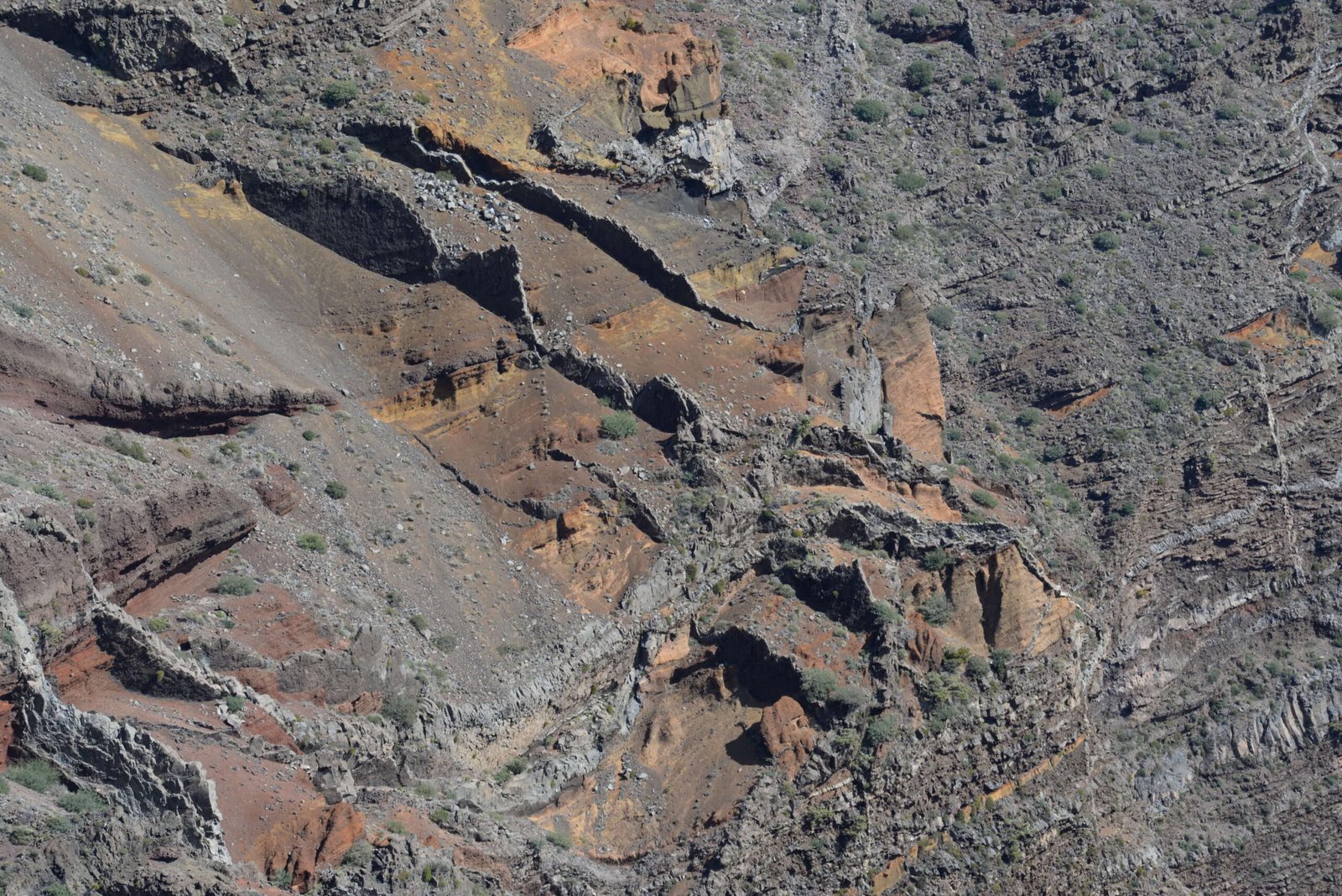
Gray lava, brown pyroclastic flows, and a web of dikes in the cliff face inside the caldera.
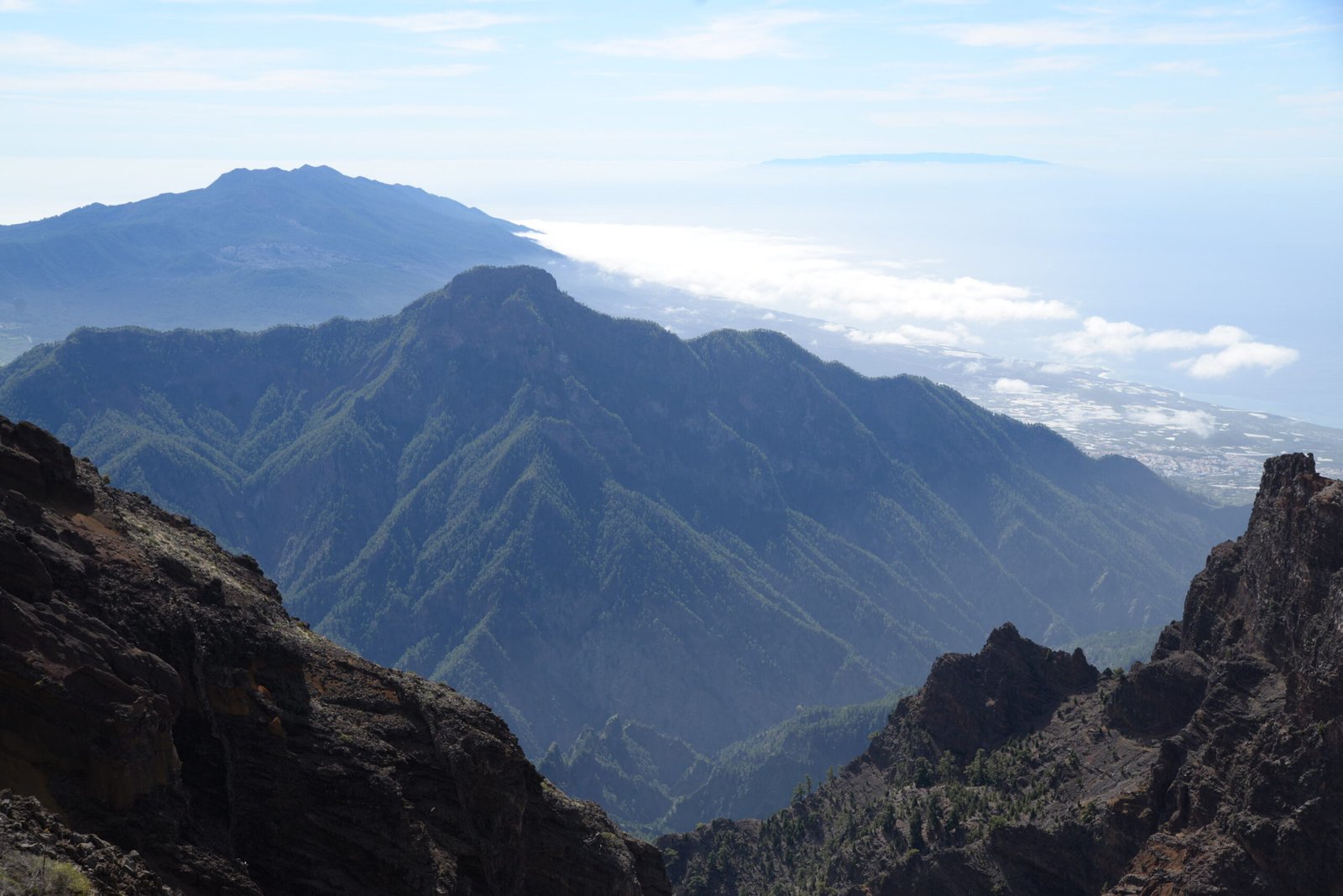
From above, the caldera somehow feels both immense and small at the same time. Immense, because the vast crater can make anyone dizzy when they lean over the railing. Small, because everything down below, trees, streams, look so tiny. And it stretches all the way to the west coast, its mouth opening toward the blue ocean like the tip of a pipette slowly dripping its contents into the sea.
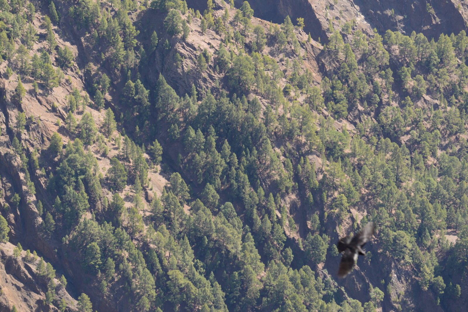
Canary Island pine covers the inner flanks of the caldera. This crow was one of several tame crows that had specialized in begging from tourists.
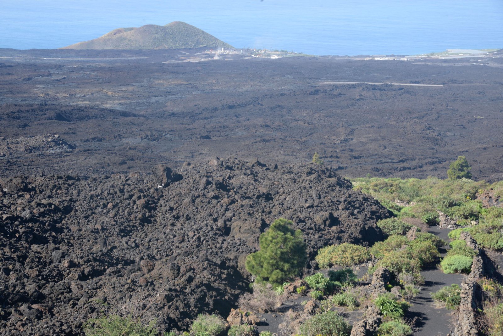
After a few hours of geological photography, it was back on the road, down the eastern side. The descent toward the capital, Santa Cruz, is just as hair pinned as the climb up, until you finally reach the coast and enter Neopalma, where the road straightens out and continues south toward Fuencaliente at the island’s tip.
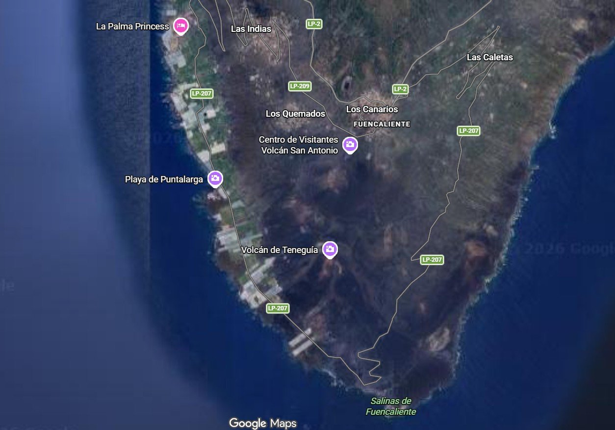
Fuencaliente, “Hot Spring”, takes its name from the island’s only warm spring, which once lay near the sea. The town sits directly on the rift zone that forms the Cumbre Vieja ridge, the backbone of Neopalma’s volcanism, and it has experienced two major eruptions in its history.
In 1677, the San Antonio volcano drowned the southern part of the town and extended La Palma’s southern tip. Unfortunately, the eruption also buried the warm spring, which remained lost until 2005, when a tunnel was blasted down to its outlet.
Then, in 1971, La Palma’s second most recent eruption occurred, forming the Teneguía crater at the southern tip. Once again, the island grew, but the lava stopped almost miraculously just short of the lighthouse at the very end.
San Antonio volcano has its own visitor center, and the trail to the volcano lies within the museum grounds. A quick look at the center, then straight on to the volcano.
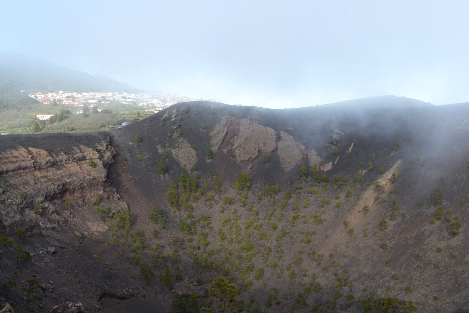
Fuencaliente seen from the crater rim of San Antonio volcano.
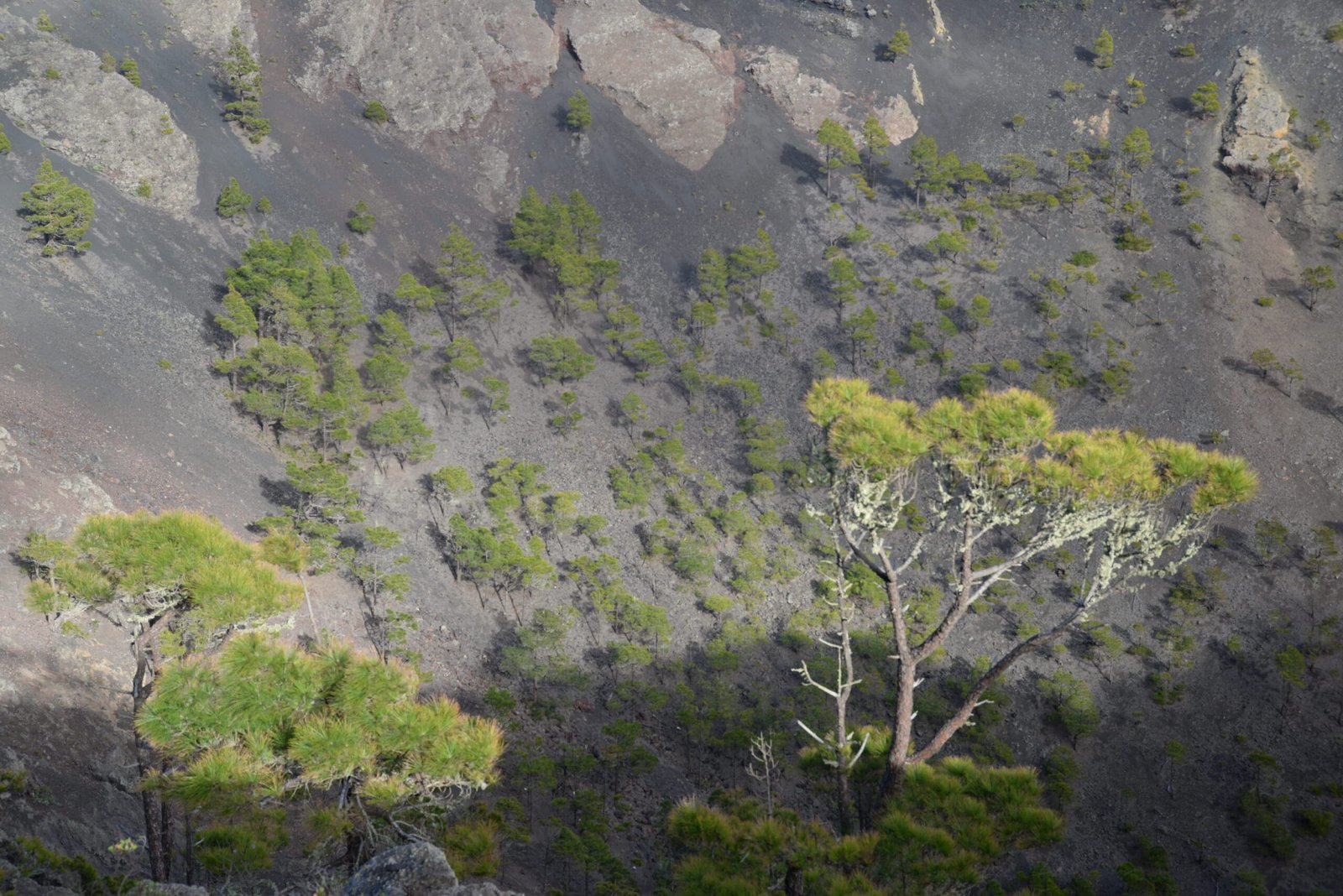
The trail follows the western rim of the crater, with views of the Teneguía crater and, in the distance, the lighthouse. Together, the two volcanoes show how life slowly reclaims stone after an eruption. Teneguía is still almost entirely black and gray, essentially a pile of volcanic ash, with a few lava flows reaching the sea. Only a handful of shrubs have managed to sink roots into the ash.
Pine trees have begun to reclaim the inside of the 1677 crater.
The older San Antonio, by contrast, is filled with scrub, and its crater is dotted with trees. It’s still mostly black and gray, partly because this is the driest part of the island, but noticeably greener than its three hundred years younger sibling. With irrigation, the volcanic soil around Fuencaliente has become La Palma’s most important wine growing region.
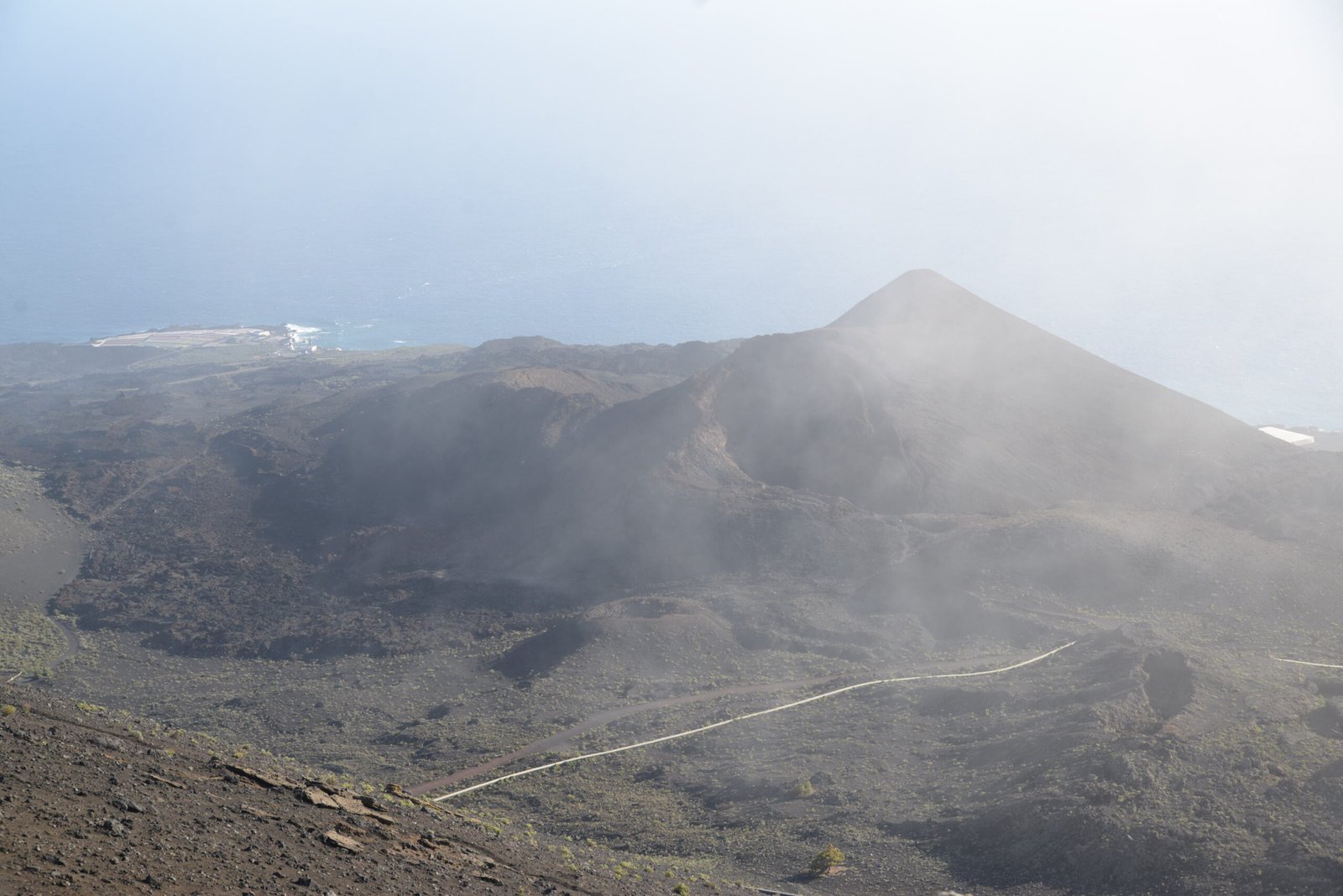
The Teneguía volcano from 1971, seen from the rim of San Antonio. The lighthouse at La Palma’s southern tip in the distance.
Access to the volcano closes at half past five, a measure to protect it from erosion. We tend to think of lava as hard, and basalt columns certainly are. But lava can also be full of bubbles and therefore porous. It can crumble as it cools, or a volcano may produce soft ash instead of lava. Millions of footprints across San Antonio would simply be too much human made erosion.
So, when geology called it a day, I headed back instead, ending the day with ice cream along the promenade together with my better half and the mini geologist, as the sun sank into the ocean.
—
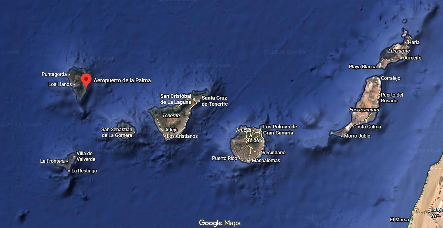
Getting there: La Palma is at the northwestern end of the Canary Islands hotspot string, and not as touristy as the bigger sisters eastwards. It is served by scheduled and charter flights from the Spanish mainland and several larger cities around Europe, notably from Germany – but none from Norway, which is why we had not visited before.
Absent a direct flight, we flew via Madrid, which is served by daily flights by Iberia. Another possibility is to fly to Gran Canaria or Tenerife, and take local flights with Binter Canarias or Canaryfly to La Palma.