Dear blog,
It’s been a while. I know. Stuff has happened. That virus, luckily it has only hit my travels, or caused the lack thereof. And something small, but very big: The little boy that arrived last November, growing bigger and bigger, crawling, pulling books out of the bookshelf, learning to stand up, with dad standing behind to take care of the HSE.
I had some plans for geo-photography and blogging during the four months dad’s leave. How young and naïve I was. Being a dad for a Mini is itself a job.
But there was a summer vacation. With international travel somewhere between forbidden and stupid, and Mini a bit too heavy to put in a mountain backpack, we stuffed our tiny Suzuki Swift with camping gear. Through the glacially carved valleys filled with salt water, a.k.a. the fjords, we headed west, to a place I had long time thought about.
Værlandet is about as far west as one can get in Norway. Nine hours in the car to cross the whole country, if you drive non-stop. We took some breaks in the fjords instead.
Once upon a time, Norway and Scotland had a love affair with Greenland and North America. A hefty, fast, wild crush and crash lasting some tens of millions of years, until they broke up. The child of that affair was a mountain chain stretching from Spitsbergen trough Norway and Scotland and we call them the Caledonides, after the latin name for the land of kilt and haggis. The Caledonides were probably as tall as the Himalayas today.
Alas, love and mountain chains seldom last forever. When the continents went from crush-crash to a tolerating co-existence, there were no more forces pushing the rocks up. The mountain chain collapsed under its own weight, and the collapse created valleys. Imagine a heap of snow in front of a shovel; the heap grows, thrusting layers of snow upon each other as long as the shovel pushes. When the movement stops, the heap collapses, creating ridges and valleys on the snow heap.
This happened with the big rock heap, the Caledonides, as well. And through those valleys ran rivers which filled lakes with sediments, the rocks that eroded from the surrounding mountain sides. In geologist language, those valleys are basins, the term for any shape with room to be filled with sediments.
In western Norway, there are four large (and a few smaller) such mountain-collapse basins, as a string of yellow rhombs on the geological map. The rhomb shape is because what-would-become-North-Europe and America did not clash in a heads-on collision, but obliquely. Like two cars smashing into each other’s sides on a slippery road, and then gliding away obliquely as well.

Værlandet from above, a.k.a. from Google maps. The dark northern part of the islands are the greenstone, which once was under and now is next to the lighter brown conglomerate.
Værlandet is a group of islands, about as far west as one can go in Norway, out in the sea where the storms hit hard during winter, and sun barely bothers to set in summer. Most of these islands consist of the rock fill in one of the mountain-collapse valleys. But not any sediment. The geological map said “conglomerate”. Could that be possible, a several kilometers thick heap of coarse rocks?
Expectations were high when we rolled onboard the ferry to Værlandet, looking forward to the rocks, and, during the crossing, a coffee and a svele, the traditional and very Norwegian thick, sour-sweet pancake that is almost as mandatory on a ferry as an engine.
Yes, I am a nerd.
Damn. No svele in the self-service-and-self-pay café. Lost in cost cuts? Svele should be part of the tender for ferry routes. Double coffee, then.
Conglomerates are coarse sediments. They consist of rock pieces, the size from pebbles to boulders, in a mass of sand or gravel. Where clay particles clan float far out at sea to sink and become shale, and sand can follow rivers for a long way, pebbles require some energy to be transported around. They flow along rivers only as long as the rivers travel steeply down in the mountains and then settle. Pebbles do not follow rivers out on the plains.
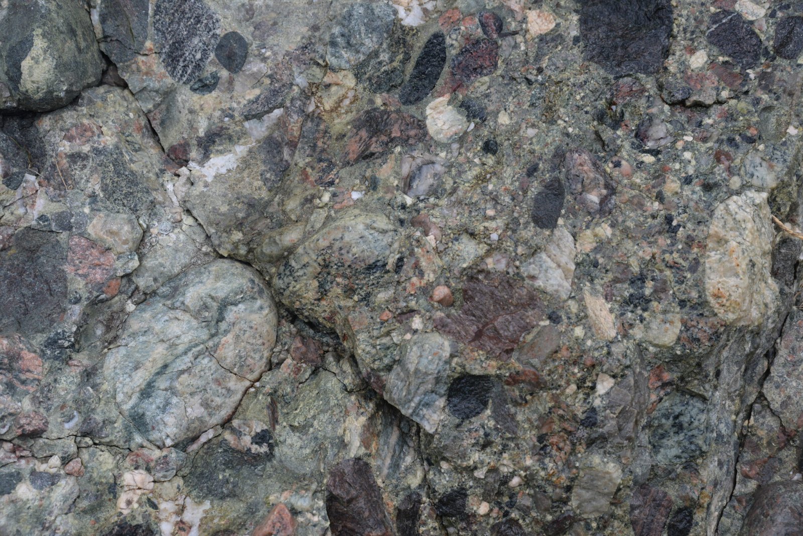
Stars, stripes and black holes: Fresh conglomerate in a road cut. The black pebbles are from the greenstone, the rest from the mountains around.
The conglomerate did not disappoint. A beautiful rock, with grey to peach sand, filled with pebbles in red, brown, black, some with stars and stripes. So pretty it is quarried and sold for decoration and building stone. And, it was conglomerate, all the way across the islands, to the points where there is only sea. Next place westwards would be the Faroes.
How do we know the conglomerate is several kilometers thick? We can drive through it, across the islands. It is tilted and stands almost vertical. The reason the conglomerate could be so thick is that it deposited while the mountain chain collapsed, so the rocks deposited as the valley sank in and rotated over a long time.
Geologists should probably tell the story of the conglomerate backwards. Start with what we see, and then the story we tell from it. After all, that’s how we find the story in the first place: We observe the rocks, measure and map them, and then make a story, which may be found true or false by new observations. A.k.a. the scientific method.
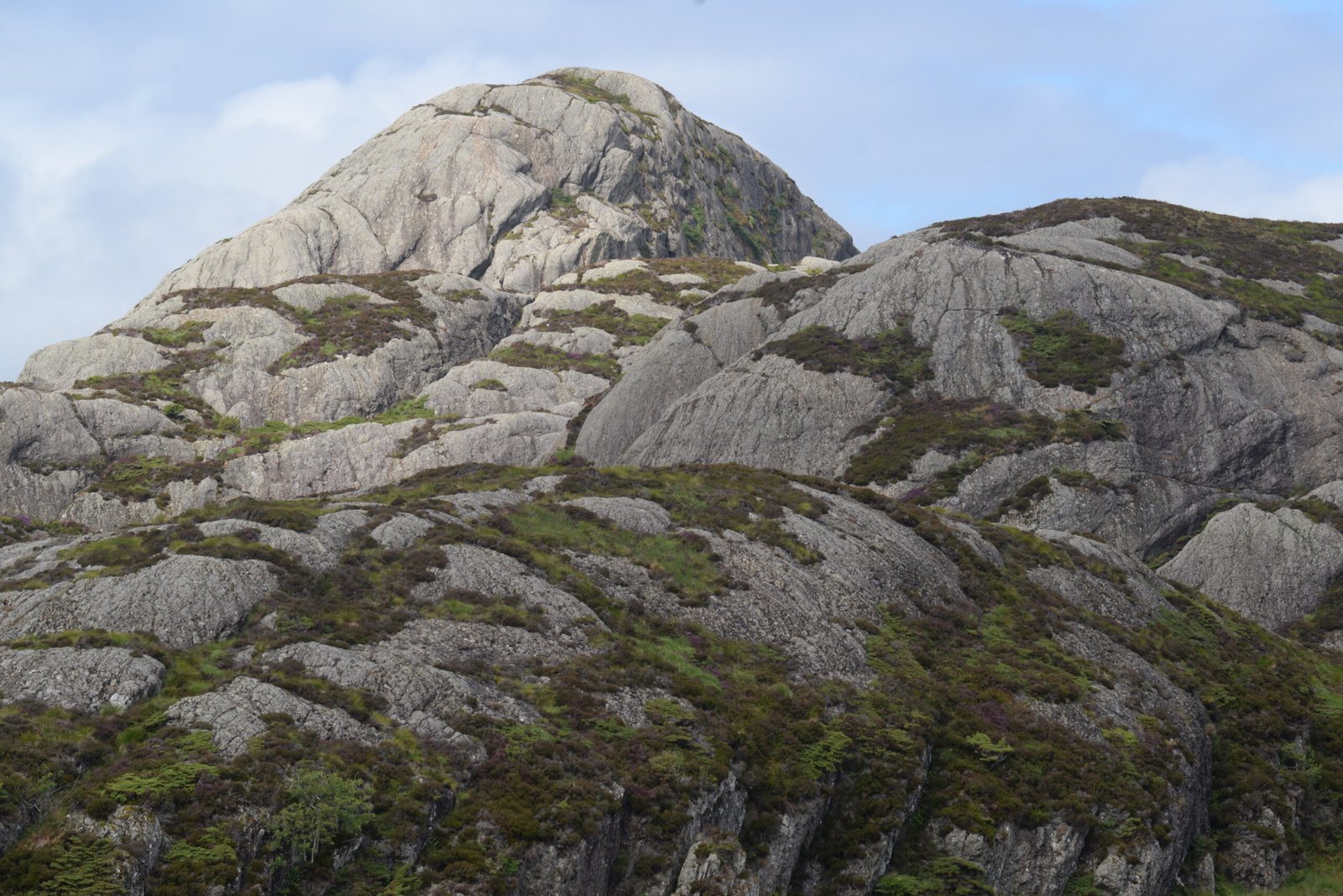
Gentle, rounded hills; a result of the soft conglomerate they are made of.
Today, the mountains of Norway and Scotland are the last remains of the mighty mountain chain. How can we know that it was so tall, a mountain chain that is no more? One way is to look at conglomerates like the one at Værlandet.
Sediments are mountains’ fingerprints. They come from somewhere. To make a clastic sediment, anything from shale to boulders, a mountain somewhere must be eroded. The coarser the sediments, the closer was the mountain. And the thicker the sediment, the more must the basin have sunk in to give space for the newly arrived rocks.
The conglomerate at Værlandet is so coarse and thick because it was deposited in a valley inside the mountain chain.
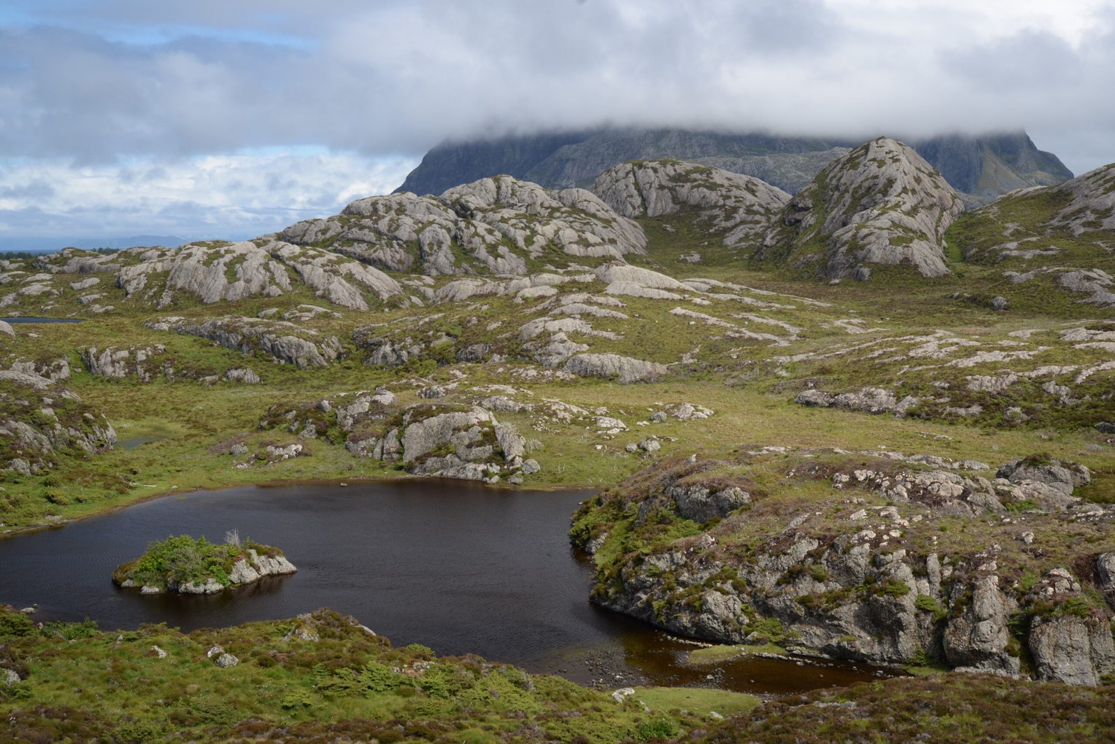
The soft, geologically speaking, conglomerate, has given Værlandet a distinct topography of gently rounded hills. The islands are wild, far out in the sea as they are, but still almost cosy in their rounded shape. A landscape of the kind that features in D2 and architecture magazines.
Værlandet is a good example of how geology influences the shape of the landscape and creates the objects of desire for our cameras. It took Mother Nature more than four hundred million years to make the conglomerate and the rounded landscape. And then we have not counted in the time of making the rocks that became the pebbles in the conglomerate.
The pebbles make almost a rainbow of colors; red, brown, white, stars and stripes. They must have come from the mountains around the collapse basin. We would probably find them on a trek around in the surrounding mountains – but that would have to be when Mini can walk for himself.

So far, he could only crawl, and needed a break from the car seat. A rain shower gave us the excuse to retreat to the local store and café at the ferry harbor. The store is the typical district combined grocery and hardware store, the kind that has everything from milk to six-packs of outboard engines, and a café which also serves as waiting room for the ferry.

Ferry. Cars. No svele. Find one error.
They had fresh cinnamon buns. And buns with custard. And raisin buns. And coffee. Luckily, the rain lasted for an hour and Mini could crawl around, spend some energy and charm everyone (we like to think).
Sure, the buns were bake off. But fresh from the oven, and at this time and place, they were as good as organic, hand-rolled buns from an artisan bakery.
Looking at the satellite image; the northern slice of Værlandet appears as dark, separated by a sharp line to the lighter conglomerate. This is the substrate beneath the conglomerate. Conglmerate must, obviously, be deposited on something, and this was deposited on a rock called greenstone – although it is more black than green.

Is greenstone the most boring looking rock on the planet? This image is just to show you how it looks, just beneath the contact to the conglomerate above.
The greenstone was originally basalt, from volcanoes that created the seafloor between the continents clashed. Then, they were pressed down inside the mountains, heated and changed to a massive, almost impressively boring blackish rock, only crisscrossed by some white veins of calcite.
With the whole basin rotating, also the greenstone beneath rotated, and today the contact between base and conglomerate is also nearly vertical. The greenstone seems to be slightly softer, at least the road climbs some meters up onto the conglomerate.
The ferry back left at four. The next left at eight. Alas, the sleeping time of Mini dictated that we had to take the one at four. We will be back before the erosion removes Værlandet.
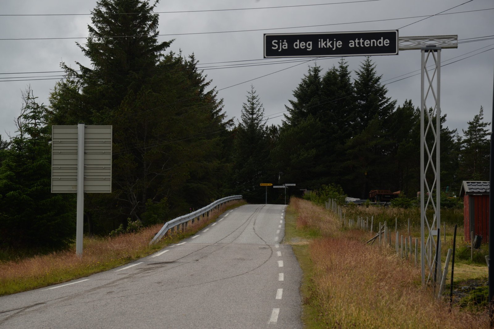
“Don’t look back”. But I will be back. I hope. .
Thank you so much. I just finished walking around Værlandet for a few hours and took a LOT of pictures, many of that conglomerate. Not being as far along in geology education as you I took a guess as to its origin. Now I know the truth. Good writing. Thank you. Paul