I am a petroleum geologist for my day time job. Petroleum geologists study sedimentary rocks, because they are the ones that contain oil (sand and limestones) or are the source for it, and keeps it in place (shale and…tight limestone).
Occasionally, we are even let out from our computer-screen-clad offices, into the real world, to look at real sedimentary rocks. The further away, the better. Svalbard has a special place in our hearts because it is very far away, and because the cold climate keeps away the damn botany that obstructs the view at warmer latitudes.
Another good thing with Svalbard is that on its western coast, the rocks have been tilted into a nearly vertical position. Sediments are by definition deposited horizontally, and that ‘s a good thing when we want to study how e.g. a reservoir rock develops in space. But what if we want to study how rocks develop through time? Then, we usually have to climb high cliffs or mountain sides, which makes us feel macho, but is inconvenient – or dangerous. Then we scream to tectonics for help, to flip the rocks.
In the Paleocene, around 50 million years ago, Greenland came to the help, as Svalbard slid by the NE edge of the big, white island. Geo-suddely, the space was too small for the both of them, and both islands got a solid punch on their front. Known as the Svalbardian orogeny, the clash created a mini-mini-Himalaya all along the western coast of Spitsbergen. Actually, the westernmost part of Spitsbergen consists of old basement rocks, and then the rocks become progressively younger inward and upward. Many places, it is just a big mess, with lots of thrust faults and pieces of rock in between, but one location have the rocks especially prettily lined up from the Upper Permian through the Lower Cretaceous: The Festningen profile in the outer part of Isfjorden.

Location of Festningen on the Western coast of Spitsbergen.

Google captures nicely how abrupt weather can change on Svalbard. The red dot points apprximately towards the Jurassic-Cretaceous boundary of the Festningen profile, with the dino-track-sandstones at the point to the right of it. Note how hard, vertical rock layers continue into the sea.
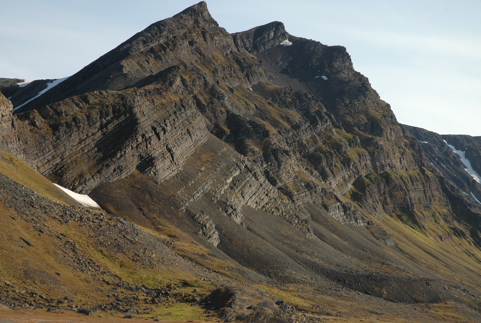
Starostinaksla, a mountain composed of hard Upper permian silica-limestone. A mighty backdrop for our walk through time.
The four kilometre long walk along the shore takes you from the Upper Permian through the Lower Cretaceous – that’s 170 million years, or roughly 43 million years per km. Efficient field work, I would say, Yoda would say. The most fascinating to me is how it shows the changing climate and geography through the time span. From shallow, quite warm marine conditions in the Permian, to the shales of Early Triassic, and then back and forth, but mostly forth, to more shallow conditions and more sand in the Upper Triassic and Lower Jurassic – the rock sisters of the sand that hosts most of the oil and gas found in the Norwegian Barents sea. Then follow the rocks that produced most of Norway’s petroleum, the organic – mainly algae – rich Upper Jurassic shales. Finally, in the Lower Cretaceous, sea became land, with rivers where dinosaurs walked.
That was the short and imprecise version, or what scientists call “the abstract”. Usually, we read only that, but as our Professors told us: It may be a good thing to hang on for the slightly more thorough story. Why do we make claims about the sea depth long ago? Let’s don some big orange survival suts and board the rib from the boat to get onshore, on the western end of the Festningen profile. Once landed, it is fun to take a bath in the Arctic ocean, as the “quack-quack-suits” keeps us afloat. Then, have a look at the rocks.
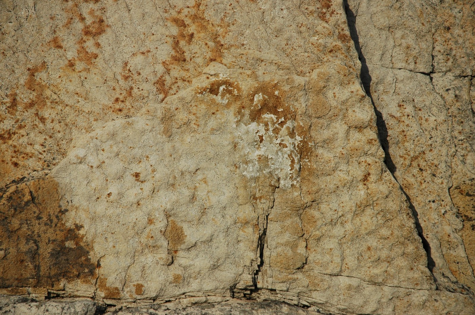
Shells are everywhere in these rocks. Some layers are even composed nearly entirely by shells. This is the Upper Permian Kapp Starostin formation, that created Akseløya, aka Fjordblock Island. In between the shells, it is composed by silica needles that likely stem from shallow water swamps, and silica cement has made it, well, rock hard.

Upper Permian silica-limestone with lots of shells.

More hard silica-limestone, with a close-up of the brachiopode shells.

And this is how they look if you take a few steps away.
Walking, scrambling, along the shore – it is occasionally steep – we cross the mother of all geological borders, into the Mesozoic, a distinct sequence border from carbonate to shale. 90% of all life on Earth died out at this border, and there are several opinions on why: Enormous volcanic eruptions in Siberia cooled the climate, poisoned the atmosphere, and – together with the initial break-up of the big continent Pangaea – may have slowed ocean circulation and depleted it of oxygen. (Note to self: I should probably write something about how I felt the mighty lines of history flow through my blood veins at this spot).

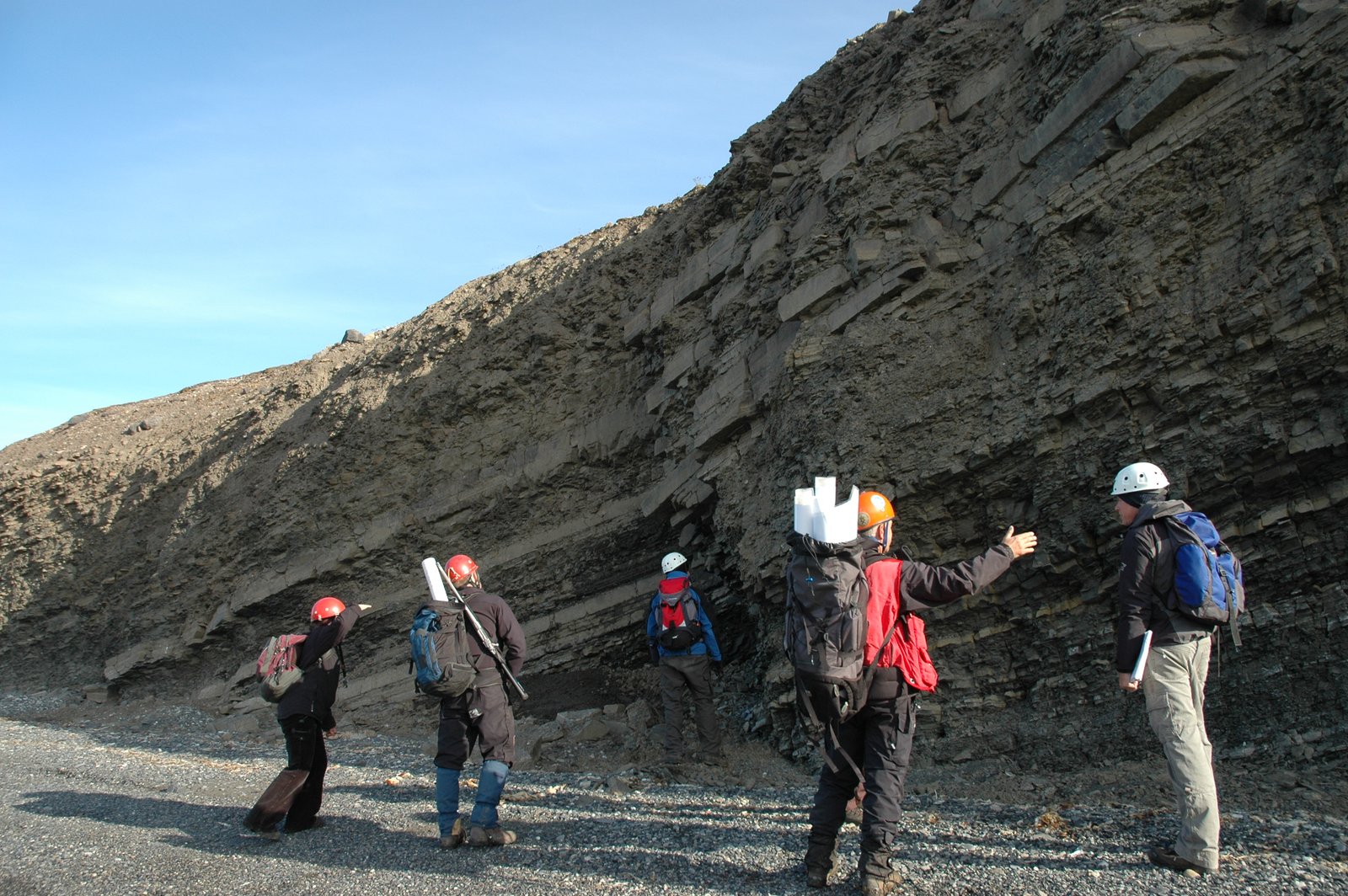
Overview of the Lower Triassic.
But why this change in the Lower Triassic? Shells survived the Big XtinctionTM, didn’t they? Part of the answer lies in the Ural mountains and Novaja Zemlja to the East: At this time, Asia met Europe and gave birth to the Ural mountains. Today the Urals are just a long, low-relief bump, with Novaja Zemlja as its northern end, but then, it was a high mountain chain. The remainder of it was eroded through the Triassic and sent westwards to build a Mississippi-eat-your-hearts-out delta in the Barents sea. Today, we know this delta through seismic data and oil exploration wells. In the Lower Triassic, the delta itself had barely filled the Russian sector, but it sent fine grained clay far away, enough to deposit as shale. In addition, the climate got colder because Svalbard drifted further northwards.

An ammonite from somewhere in the lower half of the Mesozoic. Because we all love fossils.
Through the fifty million years that make the Triassic, this big delta filled up much of the Barents sea. As it progressed, the rivers on top of the delta dumped more and more sand in its front. As we go along the Festningen profile, we see that the amount of sand increases from just the occasional channel, to many, stacked bodies of sand. As the Lower Jurassic approached, the basin was largely filled and shallow marine conditions with lots of near-shore sand prevailed.
Geologists admire Triassic sandstone beds. We are easy to please!
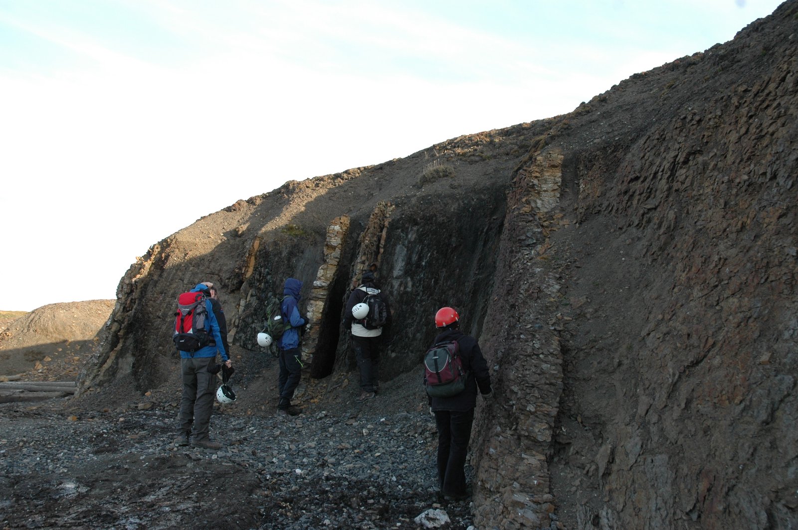
Admiring more Triassic sandstone beds…
OK, it wasn’t just that simple. The sea depth does not change only because it is filled. The sea itself may rise up and down, for several reasons: In warm climate, the sea expands and may flow over land. The amount of sea water tied up in polar ice matters. Tectonics may rise and sink the land itself, and open or close the basins, and rise or sink Svalbard itself. Or its surroundings. Therefore, when we talk about sea level fluctuations, we really mean relative fluctuations – the local difference between land and sea, the result of a complex hide and seek play, or old school romantic comedy stalk-and-flirt between sediment supply, sea level and regional topography, all written&directed by Tectonics. Therefore, this description is somewhat rough, simplified, to not drown you, dear reader, in too nerdy sedimentology details.
Walking from the Jurassic to the Cretaceous.
The border to the Jurassic should have had sign “Welcome to the Jurassic, home of Norway’s $$$, looters will be shot at dawn”. Rocks of this age hold…held?… most of Norway’s oil wealth. But in the Festningen profile, these rocks are nearly absent. Likely, it was a high during the early Jurassic. Instead, there is a sharp break to the Upper Jurassic, with an old friend, the black shale that stretches from Dorset in England in the South, to Spitsbergen and Greenland in the North. The end of the Jurassic marked an incredible bloom of algae. Then, we jump up into the Creatceous, across the Most Famous of All European Unconformities, The One that is the first to be interpreted on all seismic data: the Base Cretaceous Unconformity.
On seismic data, this unconformity usually marks a clear difference in the angles of the layers below and above. On Festningen, it is hardly discernable, other than that the shale becomes slightly less black. But then, a bit into the Lower Cretaceous, thick, hard sandstone walls block our way. Out in Isfjorden, a section of the thickest sandstone rises like a tower from the water. The profile got its name from this island; Festningen – The Fortress – home to a lighthouse and seabirds.
The Festningen sandstone is famous for its dinosaur tracks, set by a (likely) iguanodontid in the Lower Cretaceous. Not only because these were the first traces of the big bad lizards to be found in Norway in 1960 – the mainland is almost void of Mesozoic (dino-time) rocks – but also because they were found so far North. In the early Cretaceous, Svalbard was already at Arctic latitude. Climate was much warmer, but the winter nights were just as long as today, and the discovery supported that dinosaurs were not purely exothermal (cold-blooded) – today well accepted, but controversial then.
A pity then, that I do not have any nice images of dino tracks. The locality is accessible only on low tide and under an overhang. I have been on Festningen twice, but not seen the tracks. You will have to do with images of some nice ripple marks in the sand from the river they waded in. Yes, I know it’s not the same excitement…
The profile lacks the Upper Cretaceous, and although it has a bit of the Cenozoic – after-dino-time – our horizontal journey through the vertical stratigraphy ended at Festningen. Hang on next episode for crash, bang, wrinkled rocks and Svalbard’s hard encounter with Greenland, which created a mini-mini-Himalaya along its western coast.
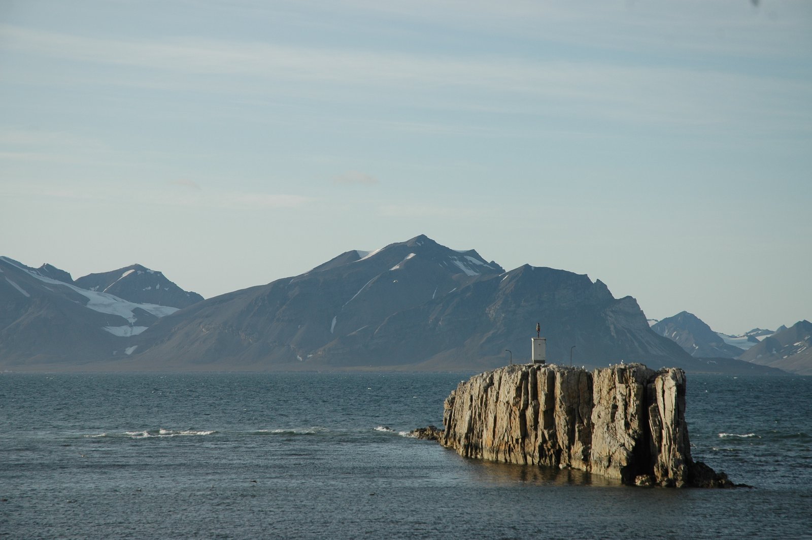
Festningen – The Fortress – in Isfjorden, made by the vertical sandstone that a river made long ago.

The Festningen sandstone wall, seen from the Upper Jurassic and towards the Cretaceous and the Paleocene.
Ripple marks from the old river that made the Festningen sandstone.
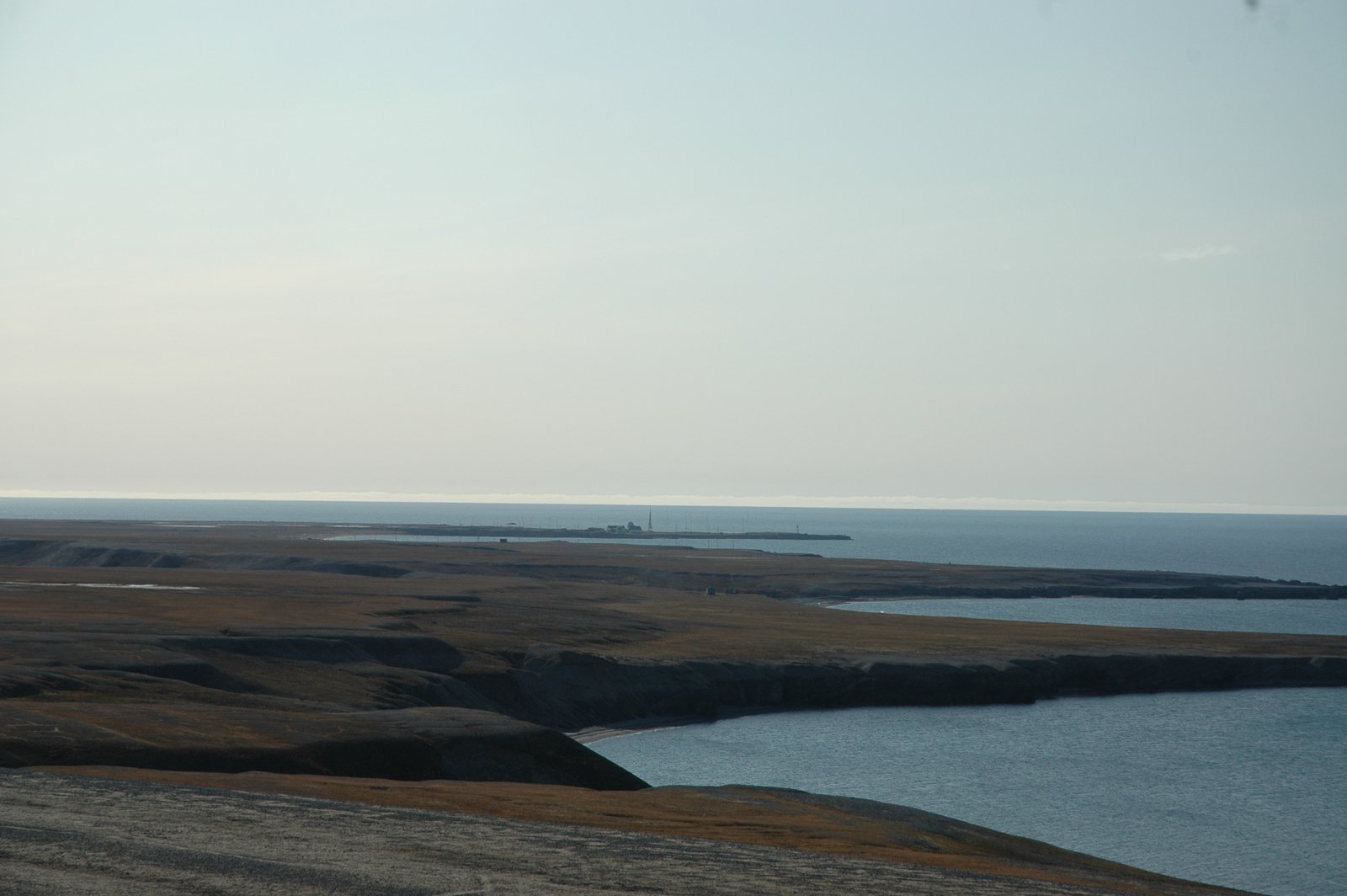
A view back millions of years, from the Cretaceous towards the radio station on Kapp Linne. The radio station itself resides on Precambrian basement. The permian succession starts at the first peninsula in the background, but the older rocks are mainly covered by that damn Quaternary.
The profile lacks the Upper Cretaceous, and although it has a bit of the Cenozoic – after-dino-time – our horizontal journey through the vertical stratigraphy ended at Festningen. Hang on next episode for crash, bang, wrinkled rocks and Svalbard’s hard encounter with Greenland, which created a mini-mini-Himalaya along its western coast.

Teaser for the next episode: A small thrust in the Triassic part of the Festningen profile. The two limbs of the skewed “A” belong to the same layer. The left limb has broken off and moved up along the right side one.

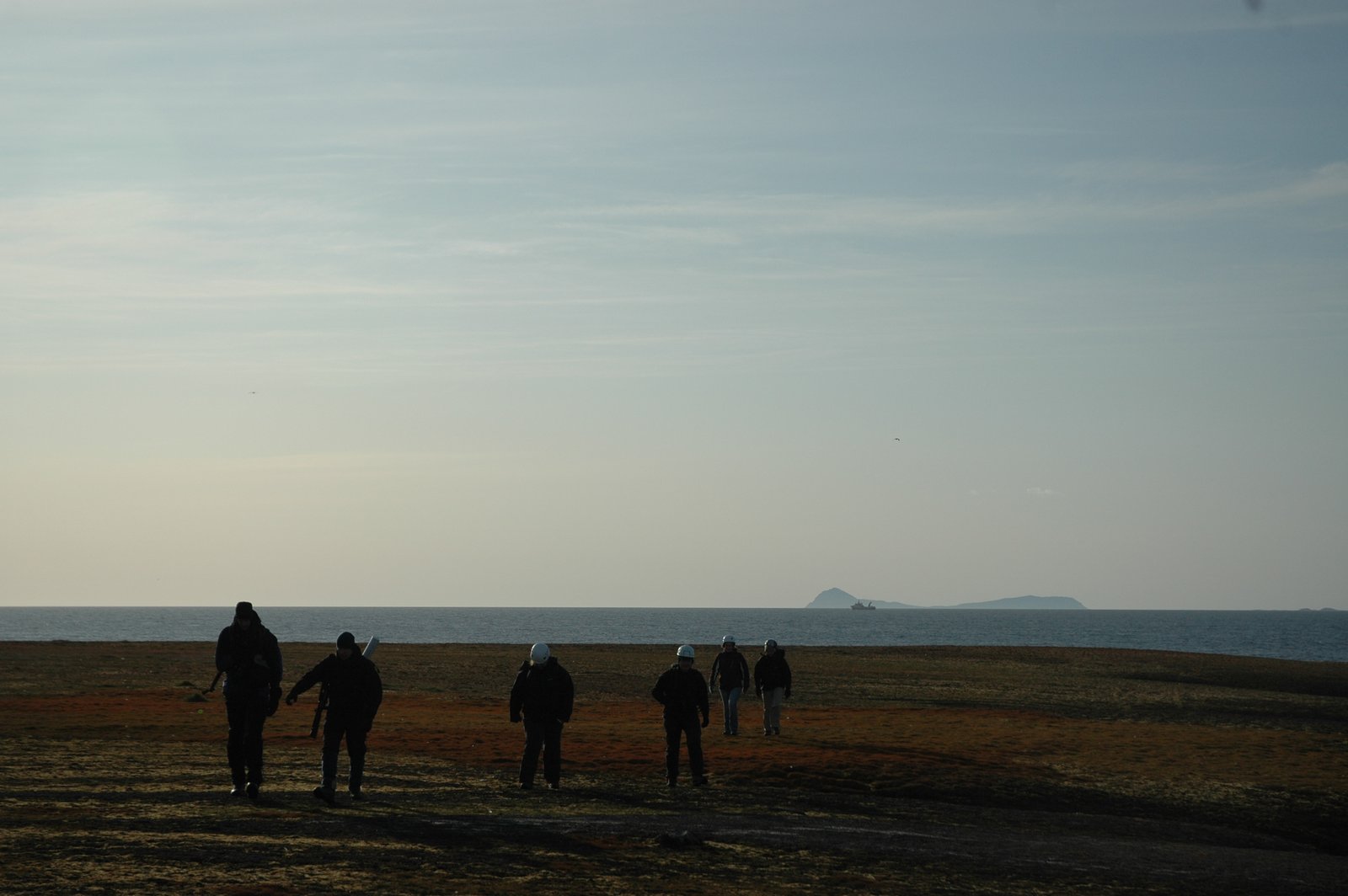
And we end with a view of the mighty landscape, and the basement mountains far away.
Pingback: Glaciers: The slow sculptors | Karsten Eig·
Pingback: When Greenland met Svalbard: A geological love story | Adventures in geology - Karsten Eig·
Pingback: How to make oil in a few easy steps | Adventures in geology - Karsten Eig·